এপিকিপিউর এ নিরাপদ এবং দ্রুত APK ডাউনলোড
APKPure বিরুদ্ধ সংকেতচিহ্ন যাচাইকরণ ব্যবহার করে আপনাকে ভাইরাস মুক্ত Territoire 06 APK ডাউনলোড উপলব্ধ করানোর জন্য।
Discover in 3D the Alpes-Maritimes territory with "Territoire 06"
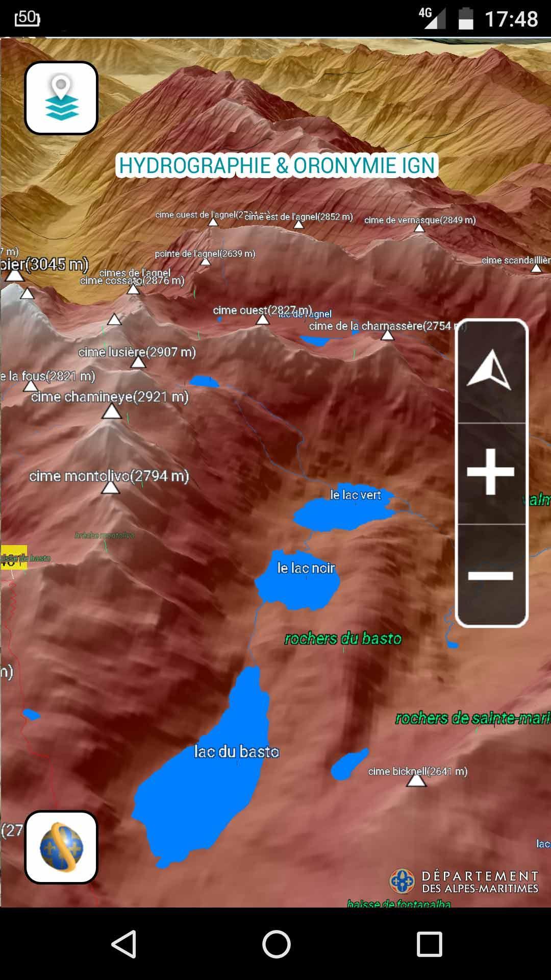
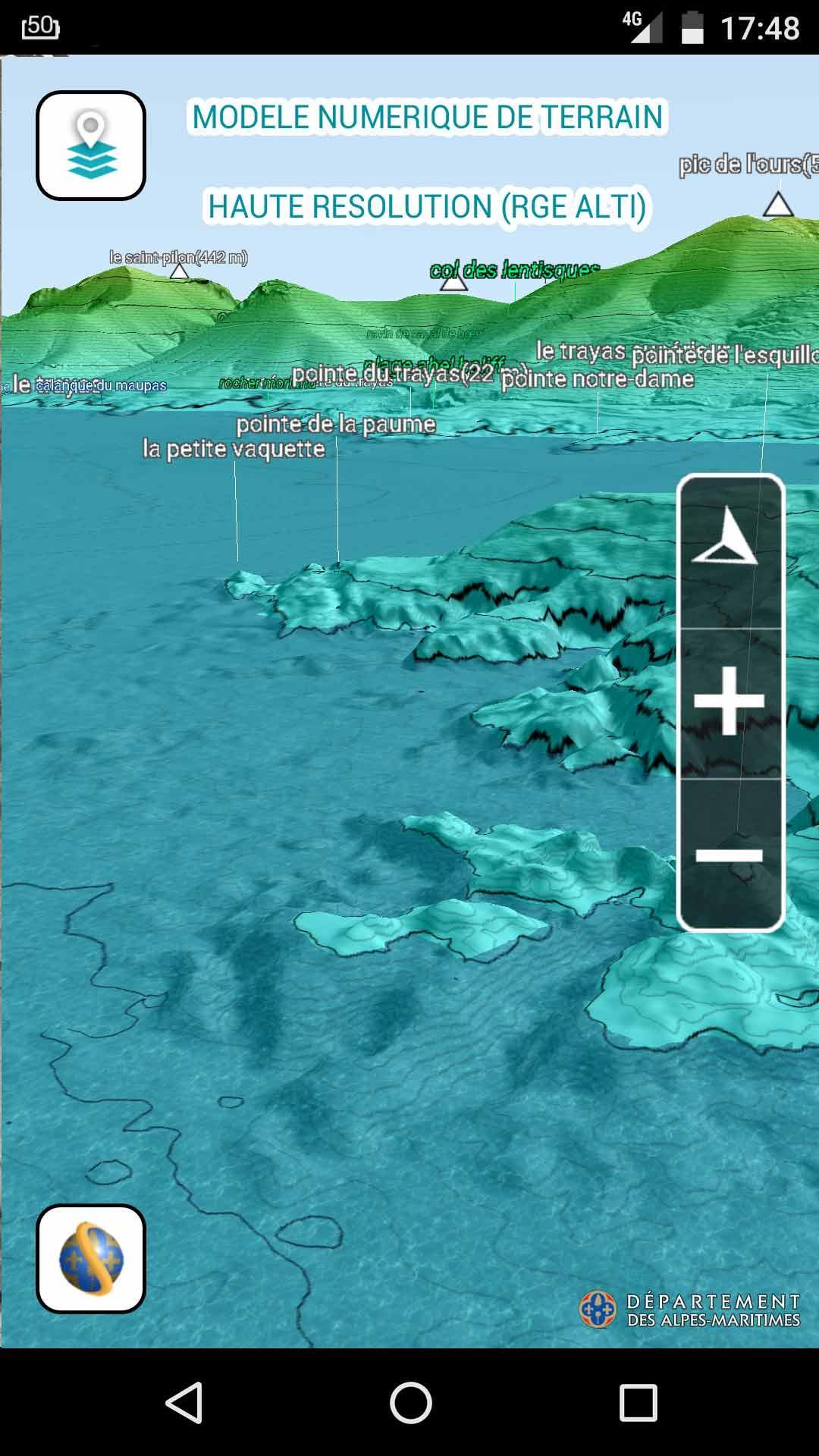
• Fly over the mountains, lakes, rivers and shores of our territory
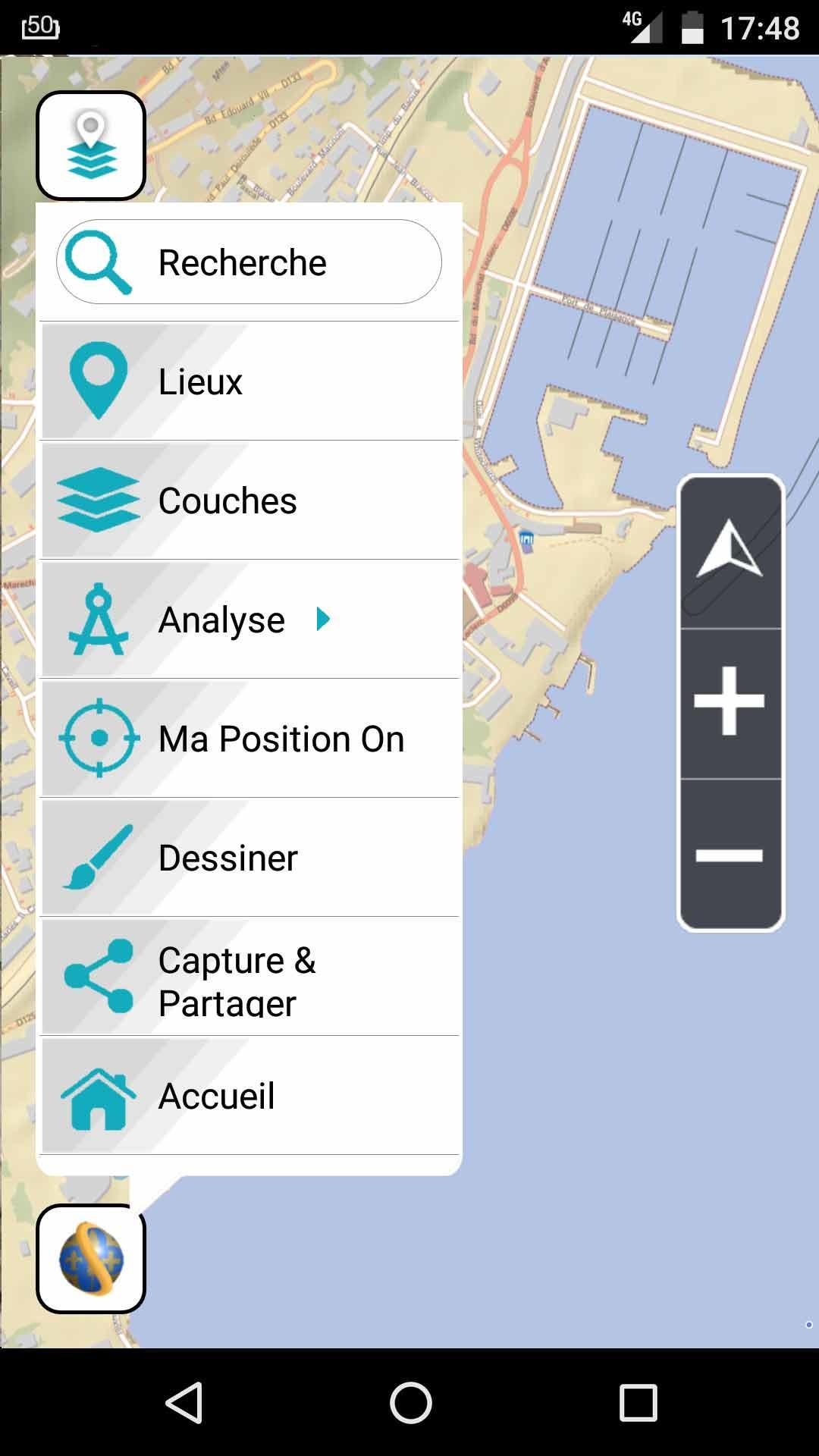
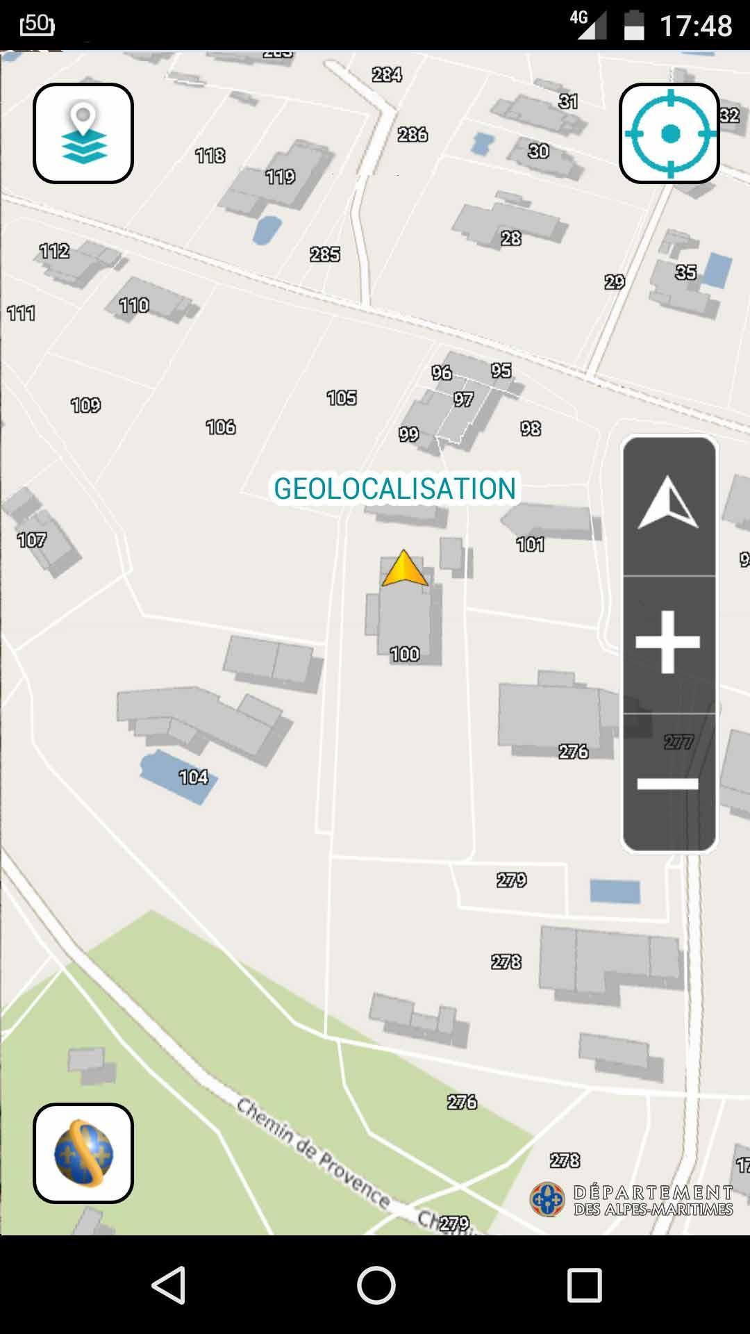
• With the "My Location" feature, localize yourself and discover information available nearby. (This feature is accessible from the menu or simply by dragging up the menu ball )
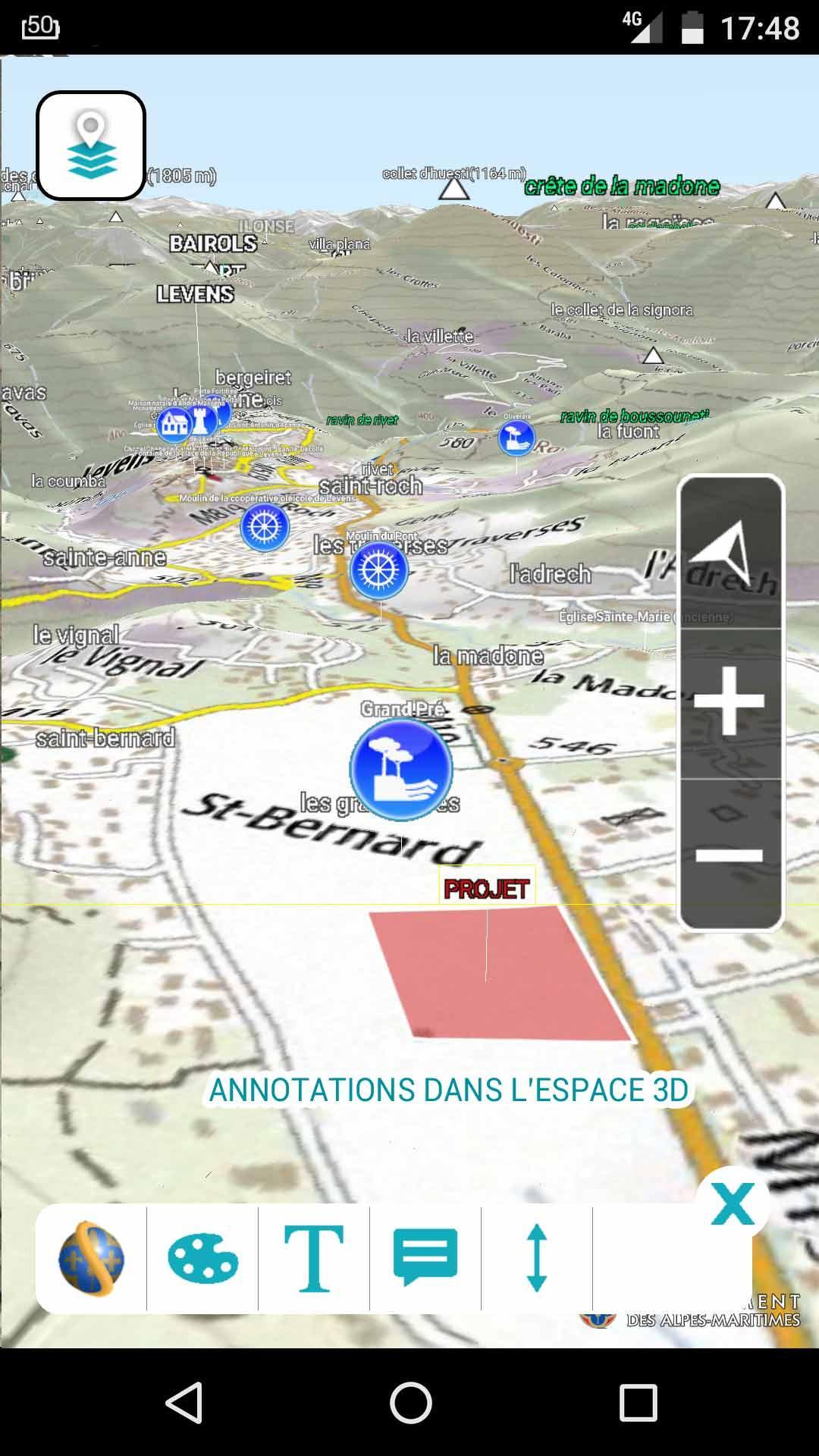
• Add information layer such as Points of Interest related to heritage sites , hiking paths, cadastral parcels, place names .... (This feature is accessible from the menu or simply by dragging the menu ball to the right )
• Annotate the 3D space and share it with screenshot
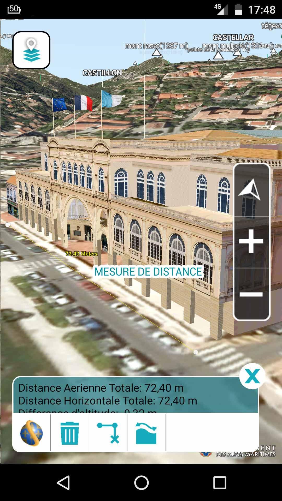
• Do simple spatial analysis to measure distances and surfaces, analysis of visibility with 3D viewshed tool, display a terrain profil, add contour and slope maps.
• Change basemaps at any time: IGN Maps, Historical maps, OpenStreetMap, France Raster or ScanExpress
• Search for a location by address or get the address of a place by clicking few seconds in 3D space.
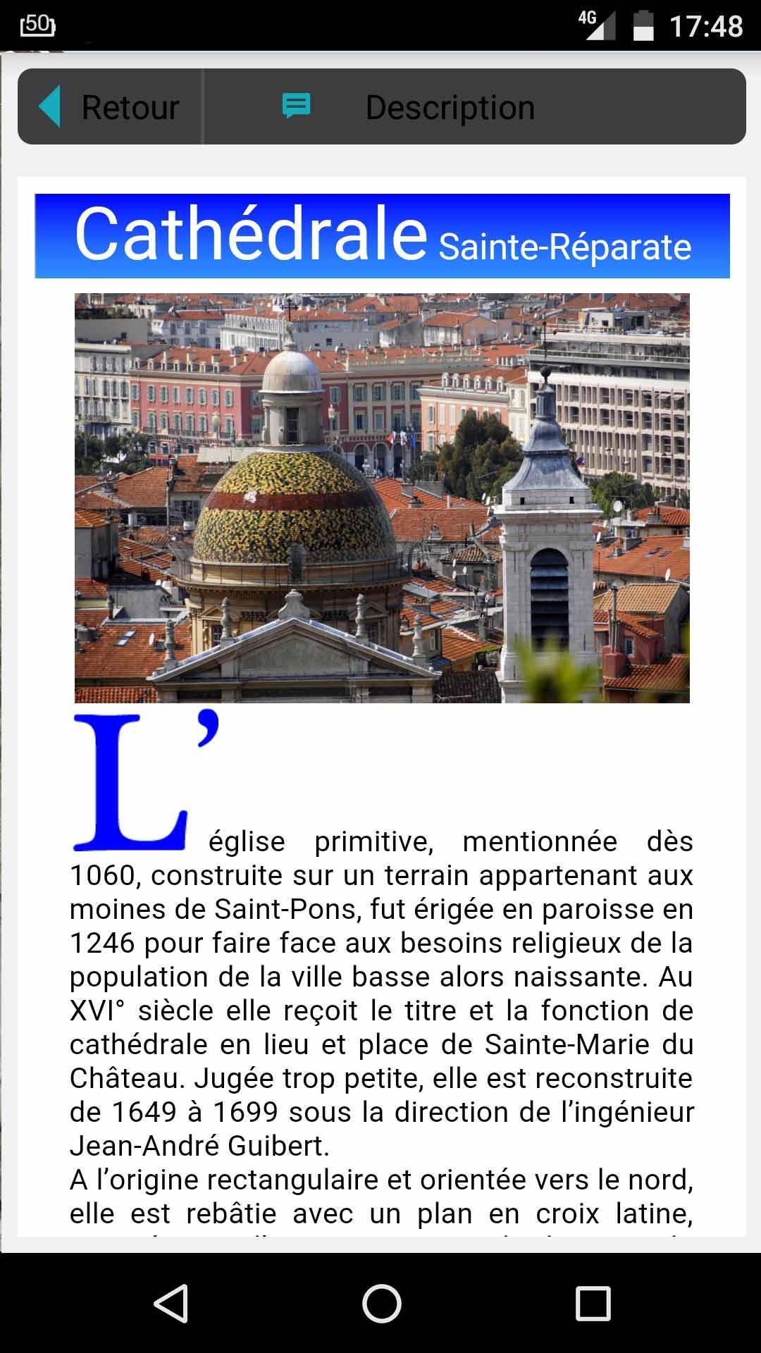
• Display detailed 3D models of some remarkable buildings or monuments.
• Discover the seabed with the "litto3D" bathymetry data (in beta).
• View detailed elevations maps with LIDAR surveys data from IGN RGEalti and Departement 06 (in beta).
• Access the Data providers list
Have greats FlyOvers !

Android-এ XAPK/APK ফাইল ইনস্টল করতে এক-ক্লিক করুন!
আপনার রেটিং এবং প্রতিক্রিয়া জন্য ধন্যবাদ!
আপনি ইতিমধ্যে রেট করেছেন।