Unduh APK dengan Aman dan Cepat di APKPure
APKPure menggunakan verifikasi tanda tangan untuk memastikan unduhan APK Geotag Location, Map, Compass On Photo yang bebas dari virus untuk Anda.
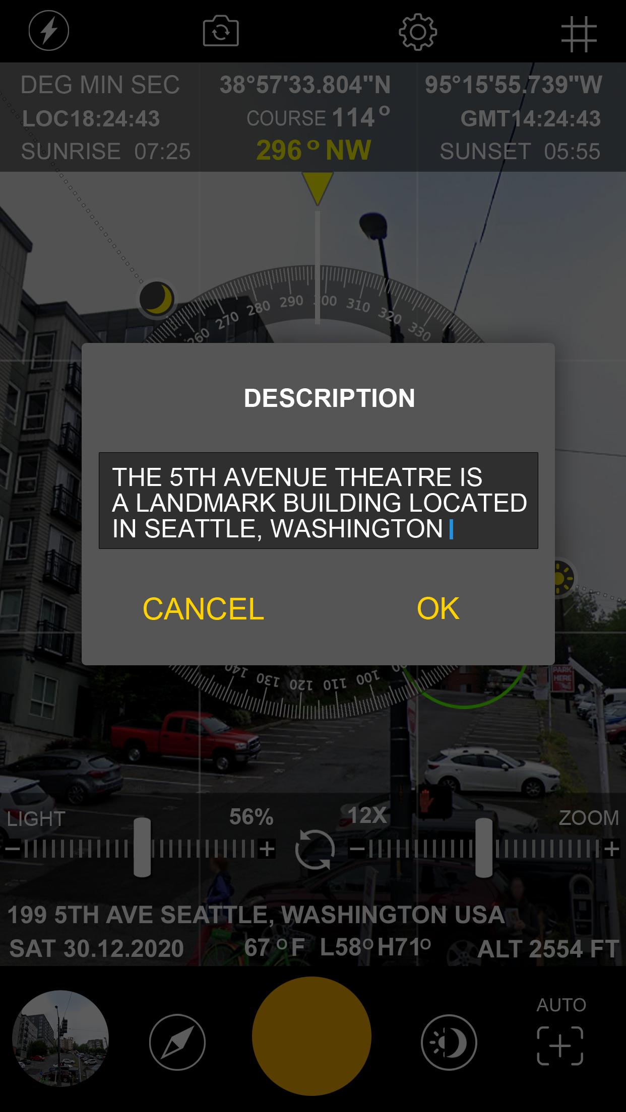
Lokasi Geotag, Peta, Kompas di foto [GPS Camera Stamp]
Features of GPS Map Camera: Geotag Photo & GPS Location:
GPS location,
compass direction
altitude,
date & time
map screnshot,
sunrise sunset ,
sun moon locator
notes such as project name and photo description
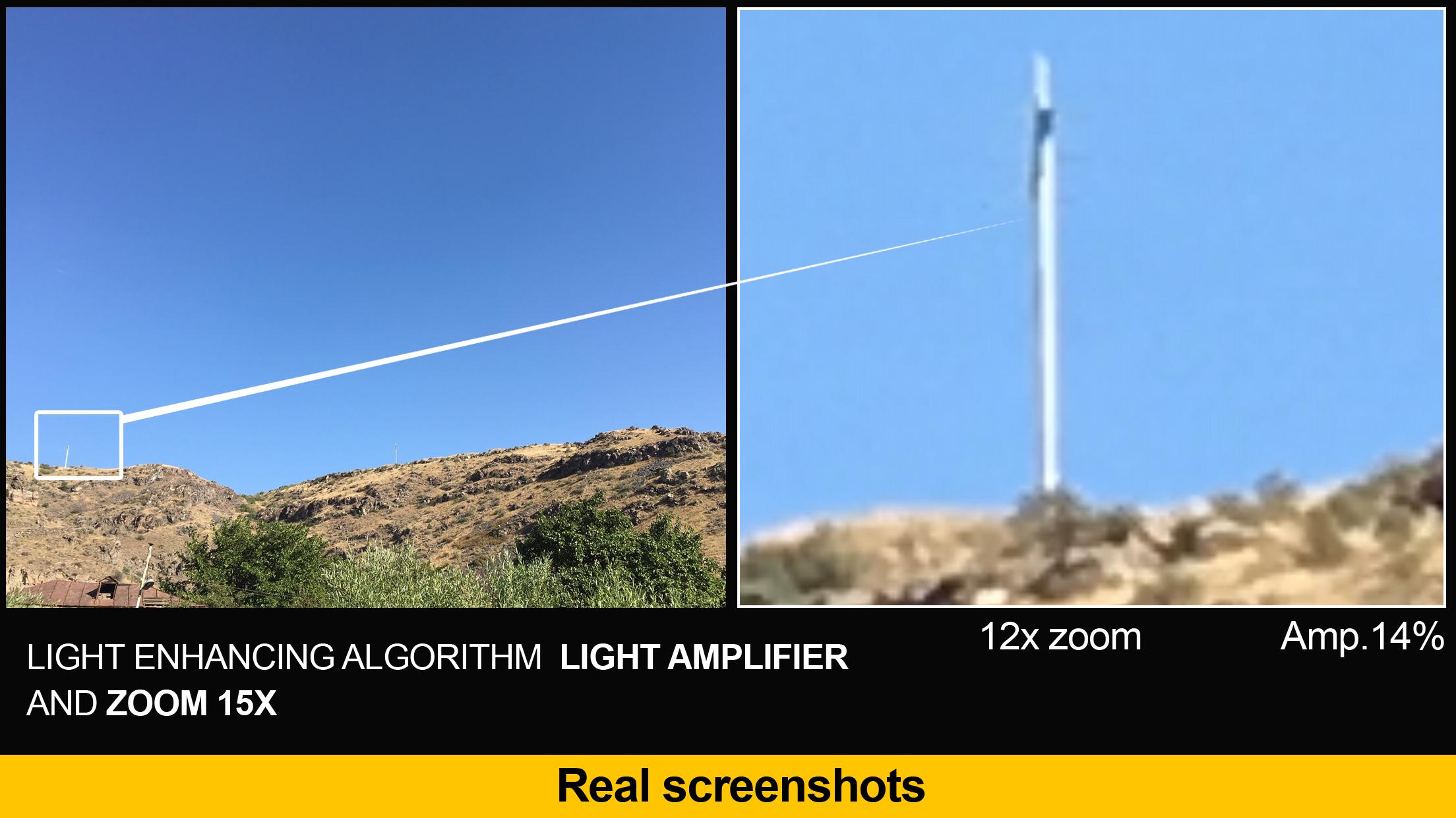
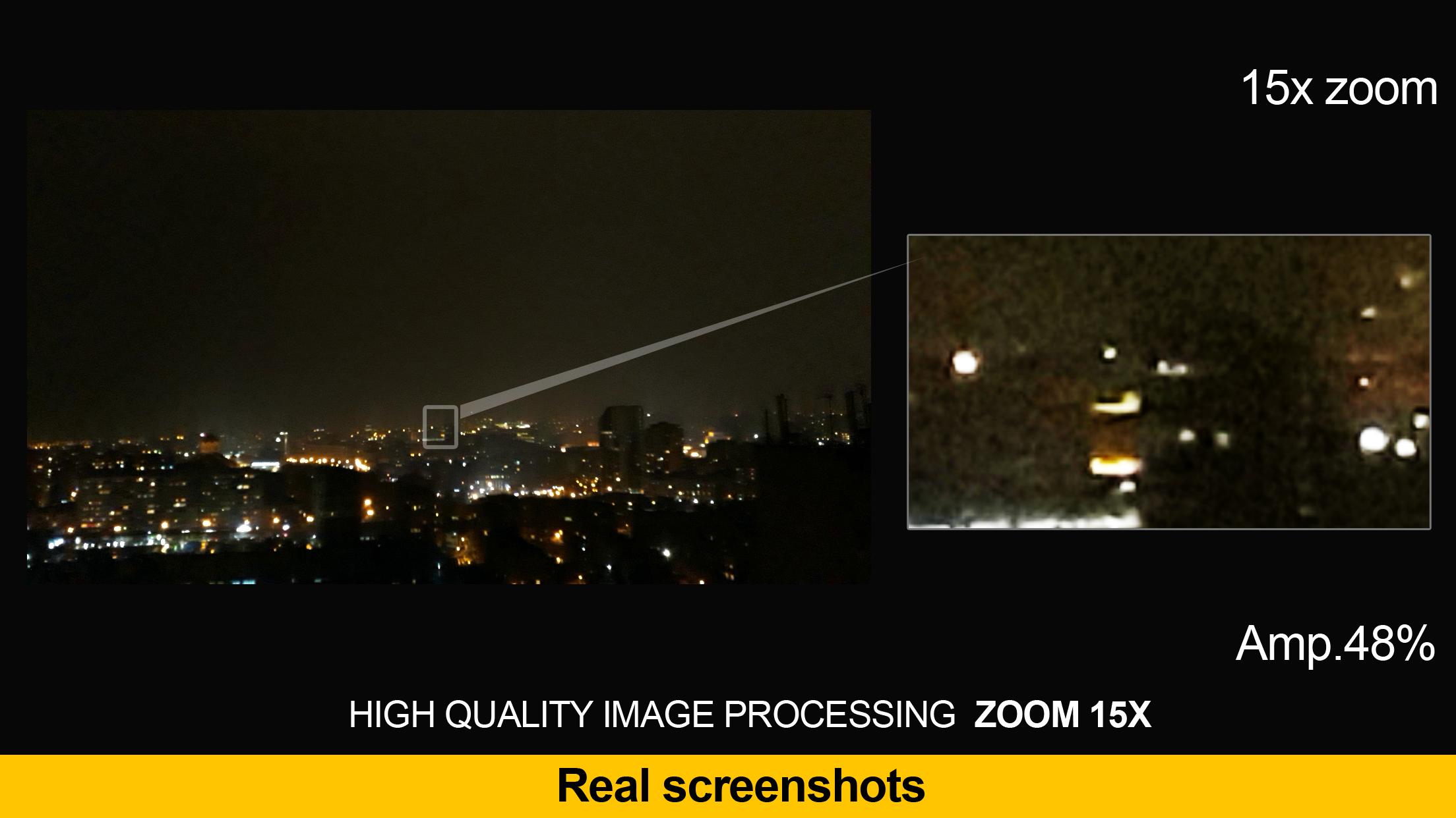
Interesting Features of GPS Map Camera: Geotag Photo & GPS Location:
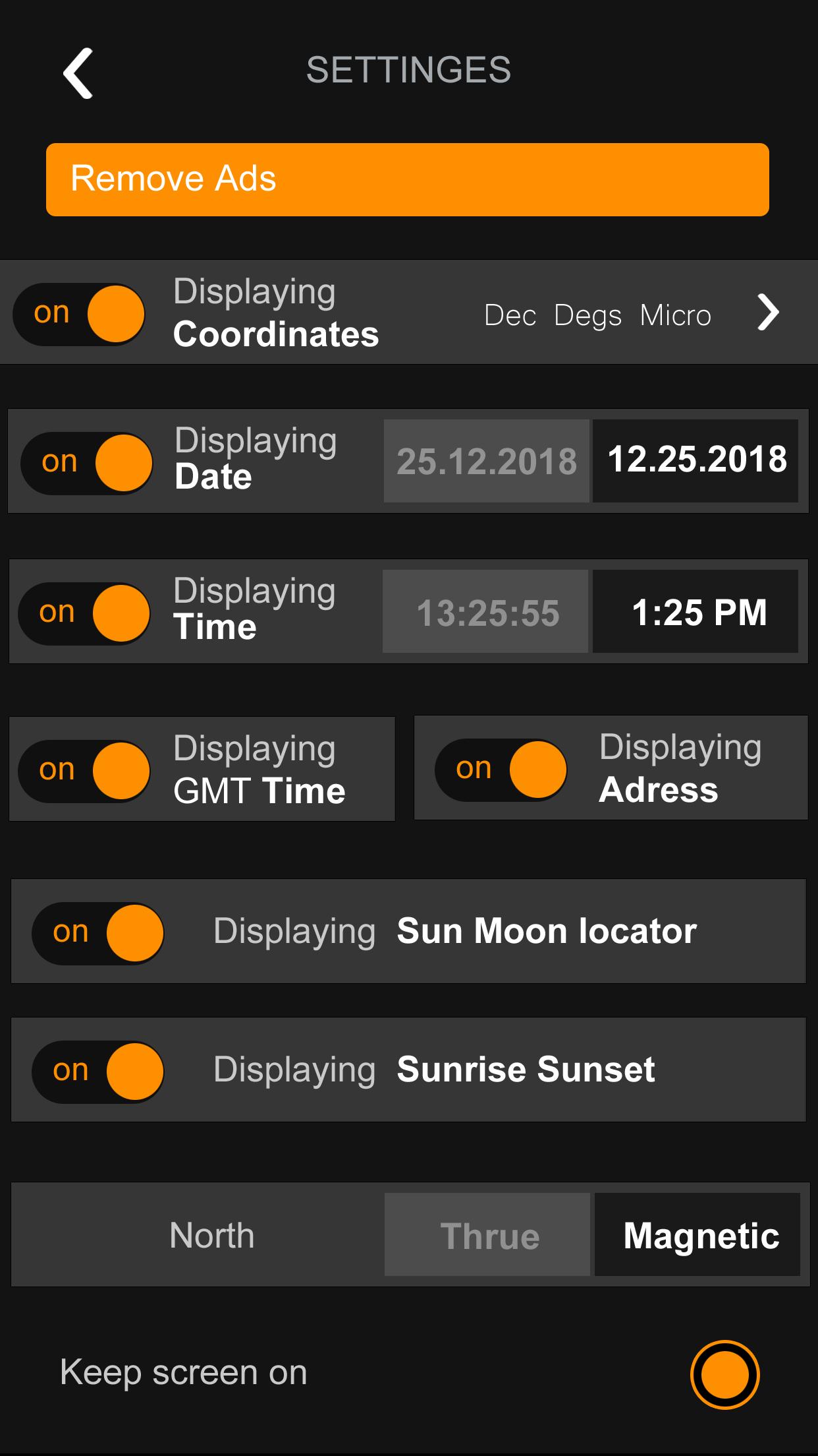
Coordinate types:
- Dec Degs (DD.dddddd˚)
- Dec Degs Micro (DD.dddddd "N, S, E, W")
- Dec Mins (DDMM.mmmm)
- Deg Min Secs (DD°MM'SS.sss")
- Dec Mins Secs (DDMMSS.sss")
- UTM (Universal Transverse Mercator)
Time Format:
24 Hours / 12 Hours
Date Format:
DD/MM/YYYY , MM/DD/YYYY , YYYY/MM/DD
Camera features:
Flash - Focus - Rotate
Units:
Meters / Feet
Directions:
True North / Magnetic North


Sekali klik untuk menginstal file XAPK/APK di Android!
Terima kasih atas peringkat dan umpan balik Anda!
Anda sudah menilai.