Download APK sicuri e veloci su APKPure
APKPure utilizza la verifica delle firme per garantire download di APK Metar Weather Map senza virus per te.
METAR Meteo Map è un collegamento della maggior parte dei rapporti meteo e mappe.
METAR Weather Map is a connection of most current weather reports and maps. It provides information about above 4000 airports all over the world. It is an excellent tool for flight planning, checking METARs, TAFs, NOTAMs and looking for interesting airports or areas with critical flight conditions.
It's created by Cybercom Poland for pilots, aviation passionates and people who need accurate weather information. We are a high-tech software consulting company located in Poland. We create software for connected world. Find out more at: http://www.cybercom.pl/
Features:
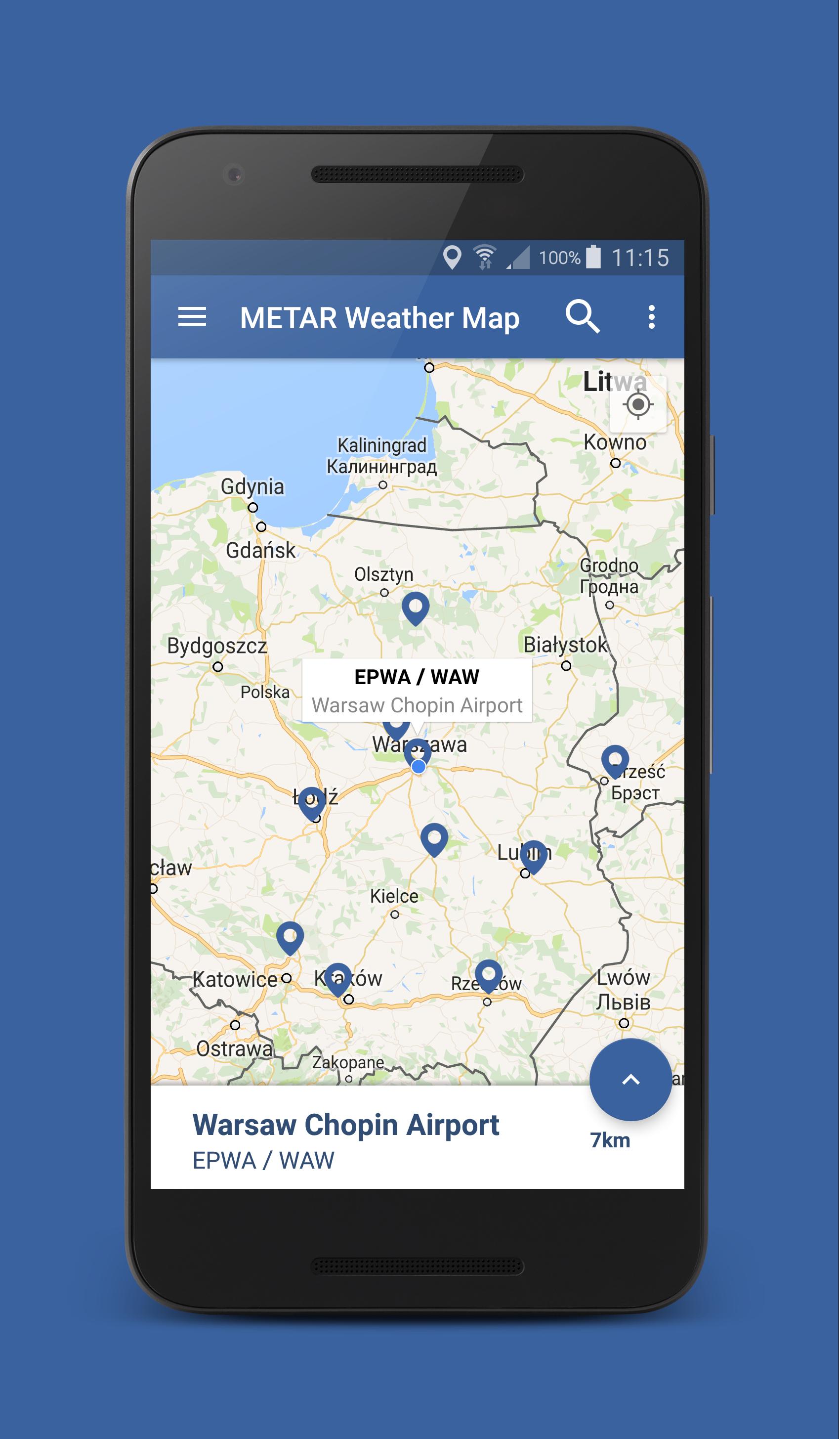
- Database provides above 4000 airports with details like location, elevation, type of airport, using radio frequencies, departures and arrivals;
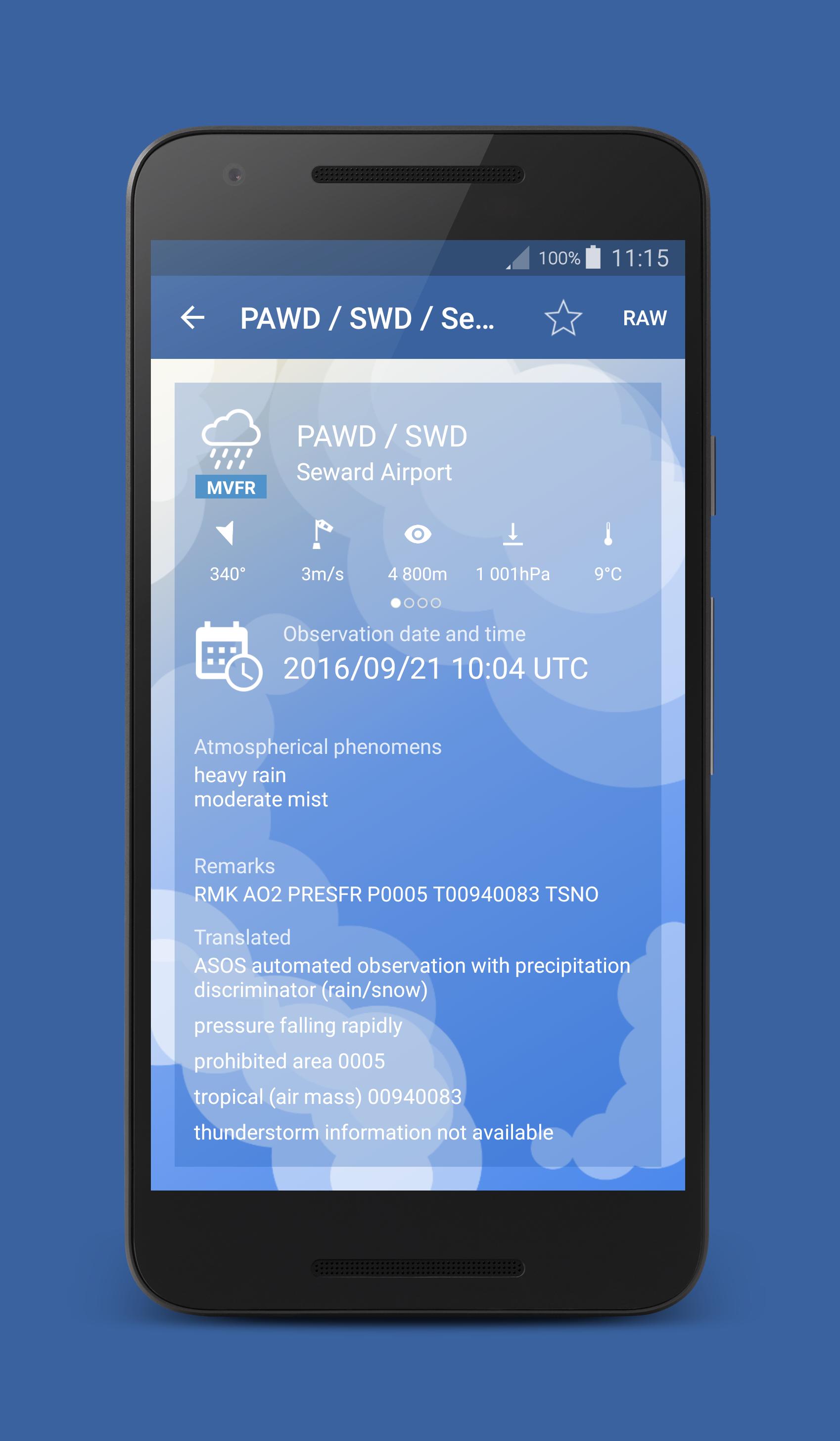
- METARs, TAFs and NOTAMs
- Marking airports on a map with different colors and icons depending on the weather and type of airport
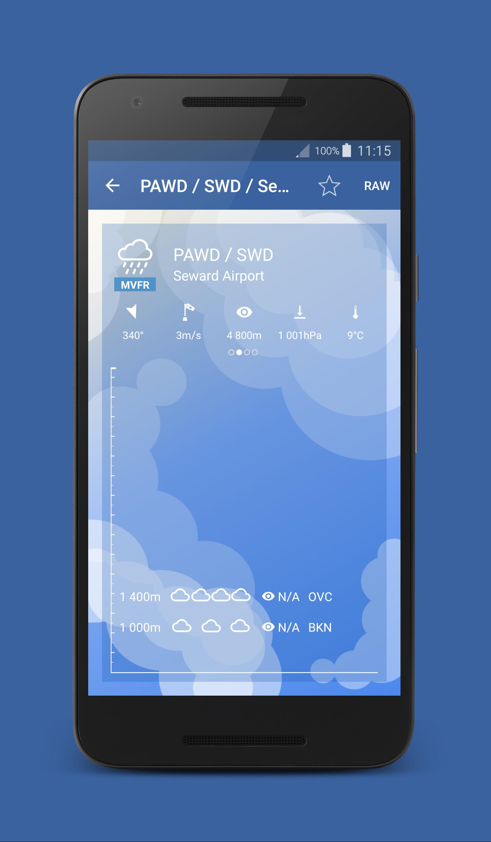
- CloudView to visualise cloud layers.
- METARs history
- Setting pages with fully customized to your preferences units
- Searching for airports by ICAO, IATA, City, Country or Name
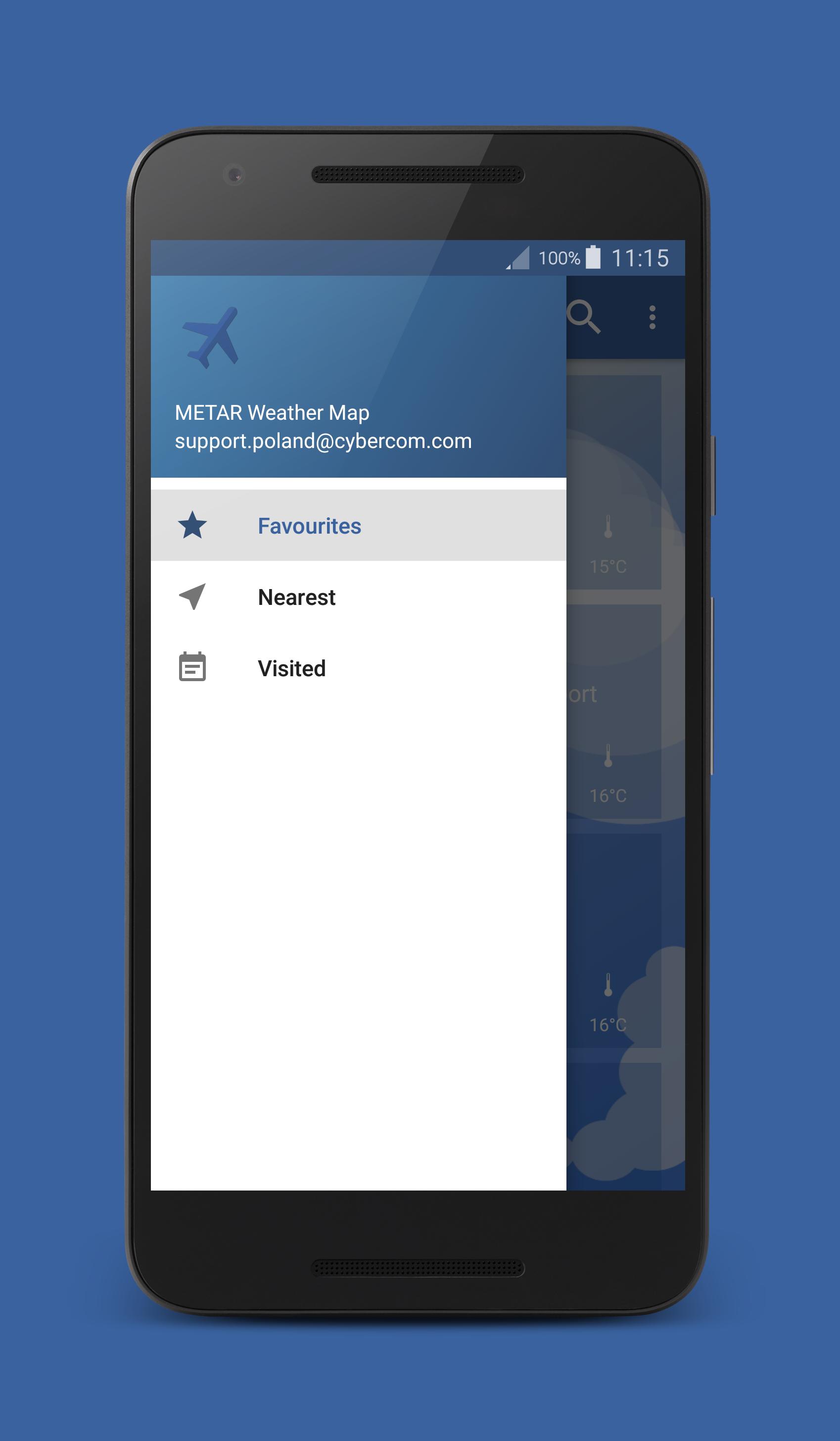
- Dashboard with your favorite airports
- Nearby airports
- Customizable flight's categories (VFR,MVFR,IFR,LIFR)


Basta un clic per installare i file XAPK/APK su Android!
Grazie per la tua valutazione e feedback!
Hai già valutato.