Veilige en snelle APK Downloads op APKPure
APKPure gebruikt handtekeningverificatie om virusvrije kml Generator for Drone Mapping APK downloads voor u te garanderen.
Vierkante rastergegevens van 500 of 1 km voor het in kaart brengen van drones
This App is designed for kml file generation which is imported by auto pilot application of drone.
Each grid location address is named by MGRS format
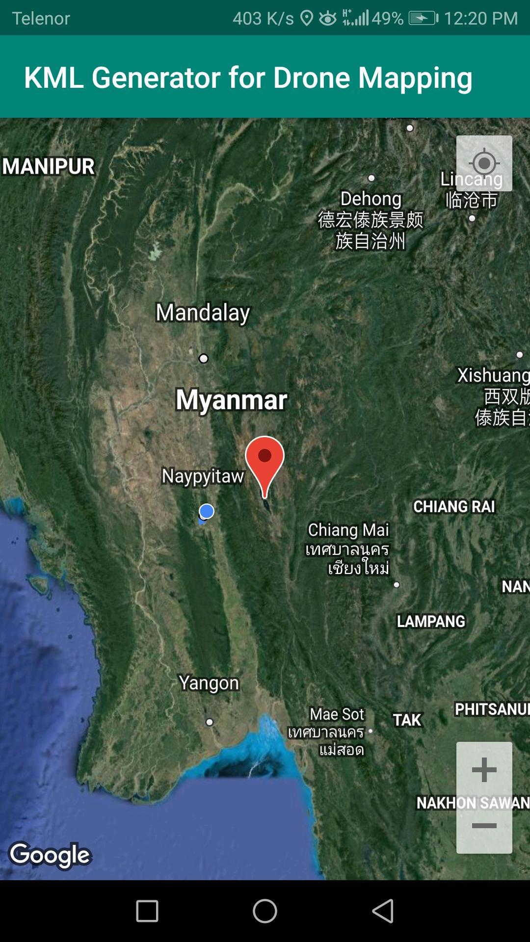
step 1 - Move to the target area and tap it
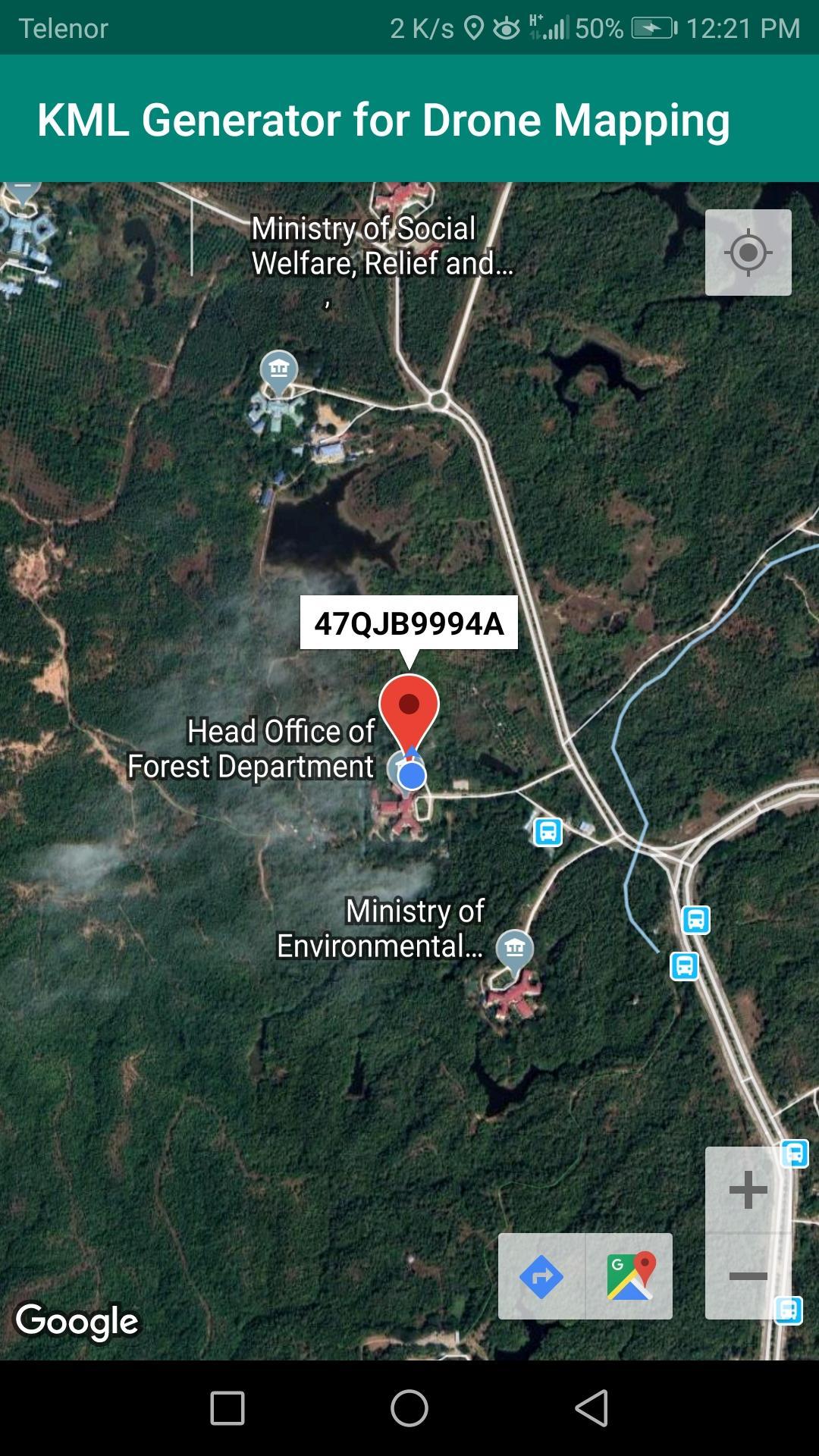
step 2 - Tap the Marker -> Location window shows
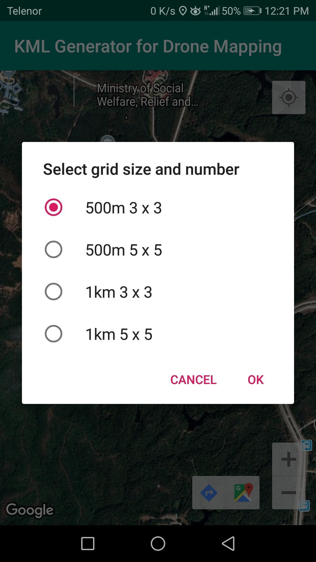
step 3 - Tap the location window -> Menu shows
step 4 - Select the size and number of grid
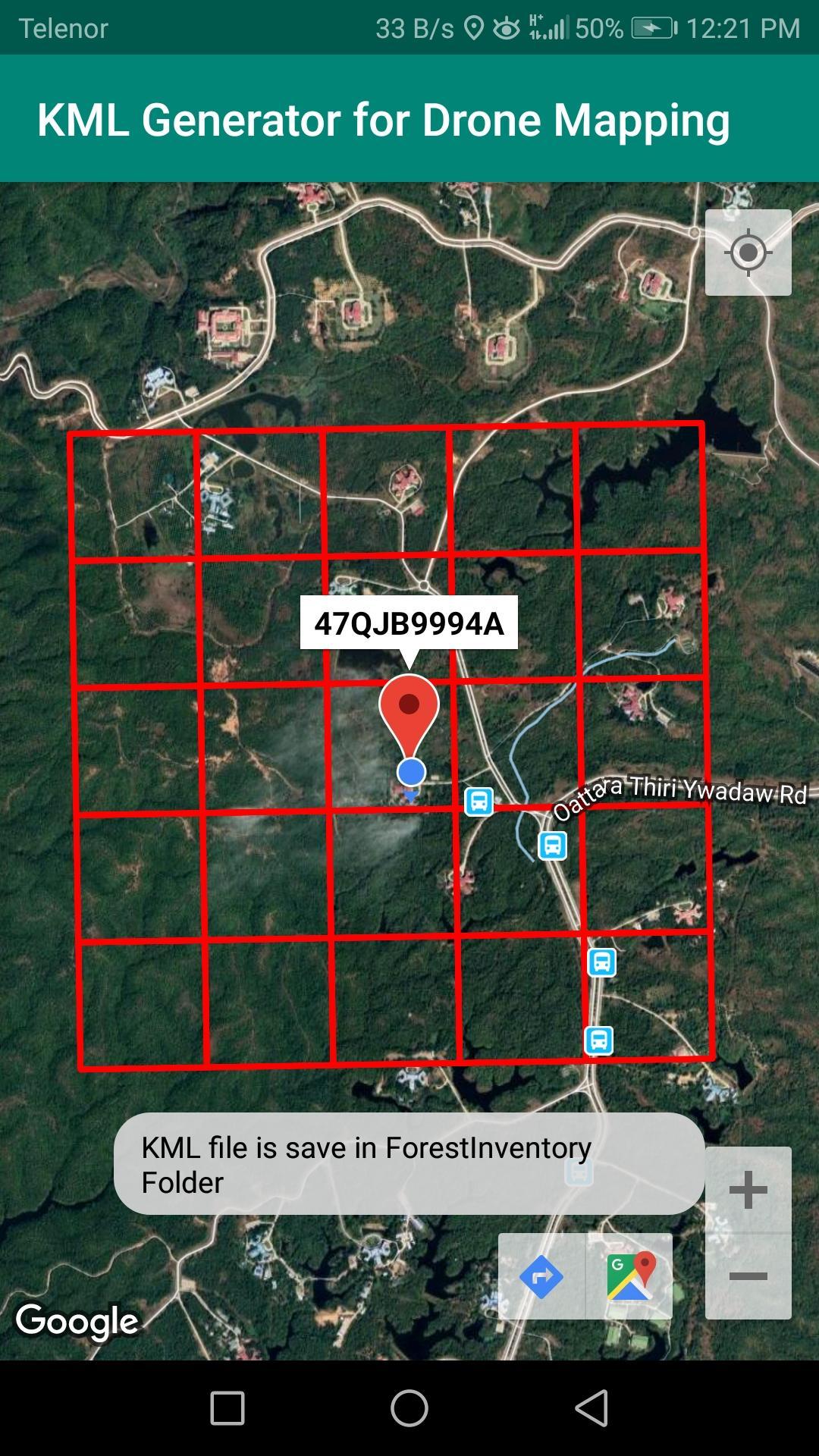
step 5 - Tap OK -> KML file is generated, and shows on map
KML file is save in \ForestInventory\ #######x3(5).kml
step 6 - Copy or send KML file to drone operation tablet, and import by auto-pilot application
Eén klik om XAPK/APK-bestanden op Android te installeren!
Bedankt voor je beoordeling en feedback!
Je hebt al beoordeeld.