Bezpieczne i Szybkie Pobieranie APK na APKPure
APKPure używa weryfikacji podpisu, aby zapewnić bezpieczne pobieranie plików APK SAFER Mobile Response bez wirusów dla Ciebie
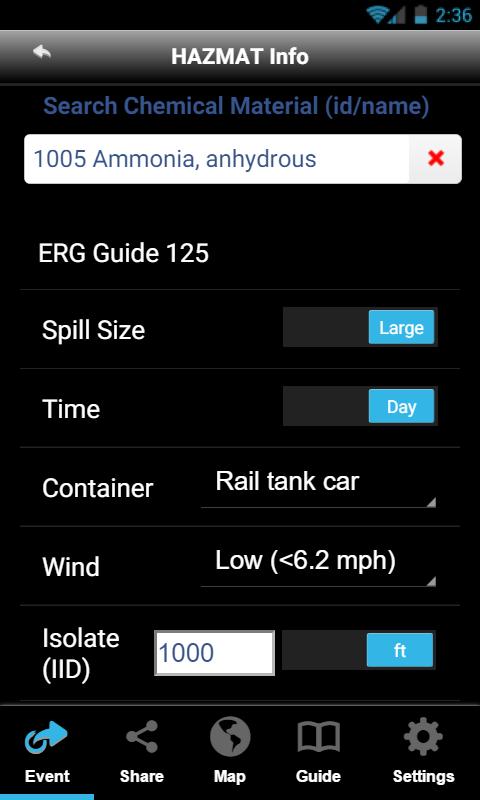
2016 ERG przewodnik spotkał danych, chemia danych oraz odległości zagrożenia kreślone na Mapie
SAFER Mobile Response™ is a FREE mobile app designed for First Responders and HAZMAT
SMEs that seamlessly integrates the latest 2016 Emergency Response Guide (ERG) into an
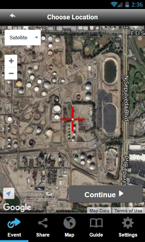
intuitive user interface. Impact zones, protective action distances, and initial isolation are all
easily visualized on top of Google Maps® with live traffic and weather - with simple workflows.
The SMR App provides critical situational awareness and vital site information to Incident
Commanders and First Responders – enabling better decisions. SMR includes Points of Interest
(POIs) that fall within the effected zone. Incident maps with impact zones of chemical releases
involving TIH’s can be shared by email during an event so that each team is working off the
same visual information. Each event can be saved to a user’s profile for review later.
Key Features:
• 2016 ERG Integration and Map Visualization of IID and PAD
• Live Internet Weather and Traffic with Points of Interest (POIs)
• Create and share incident snapshots via email
• Unified Login for SAFER One RT™ Users
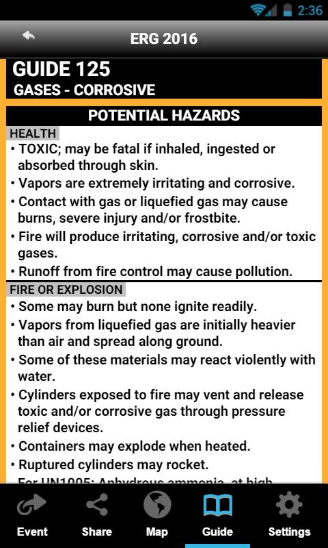
• Quick Reference ERG pages and the entire ERG content in PDF
For more information, go to https://www.safersystem.com/our-products/safer-mobile-response/


Jedno kliknięcie, aby zainstalować pliki XAPK/APK na Androidzie!
Dziękuję za ocenę i opinie!
Już oceniłeś.