Use APKPure App
Get vTools for Survey (Free) old version APK for Android
Mekansal veri toplama Point, Polyline, Polygon, Tracklog ve daha fazlası
The application makes mapping, management planning and field inspection simple, fast and convenient.
Fully integrated with the same functions as a handheld GPS and also adds many new functions to turn your phone into a powerful tool to support surveys, surveys and planning. Field management is the easiest.
The main functions of the application:
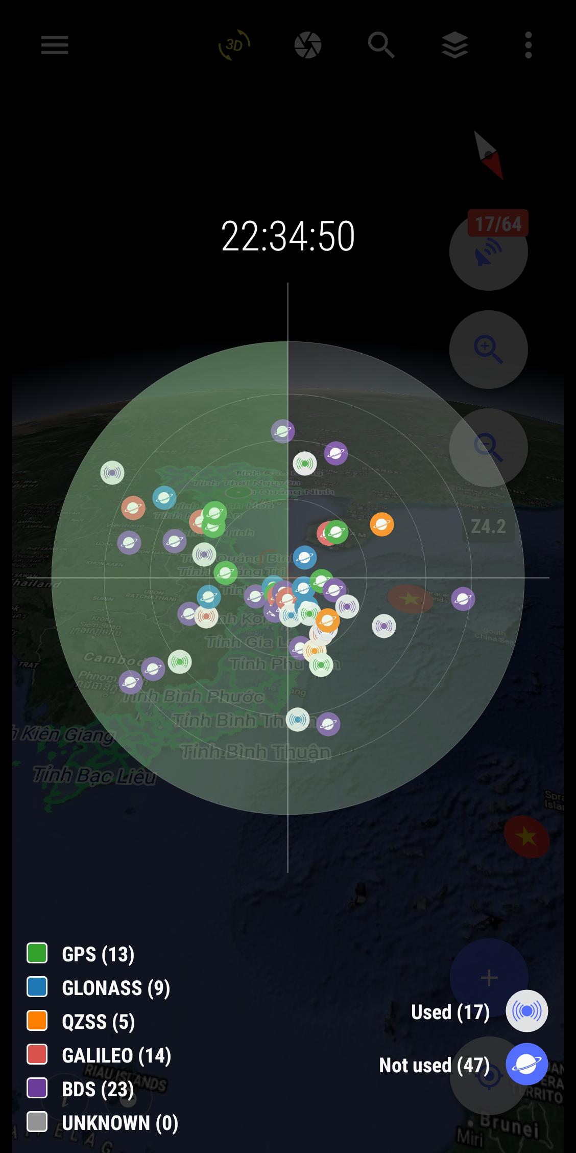
- Positioning, current position, practical view angle in the field. Help identify better directions.
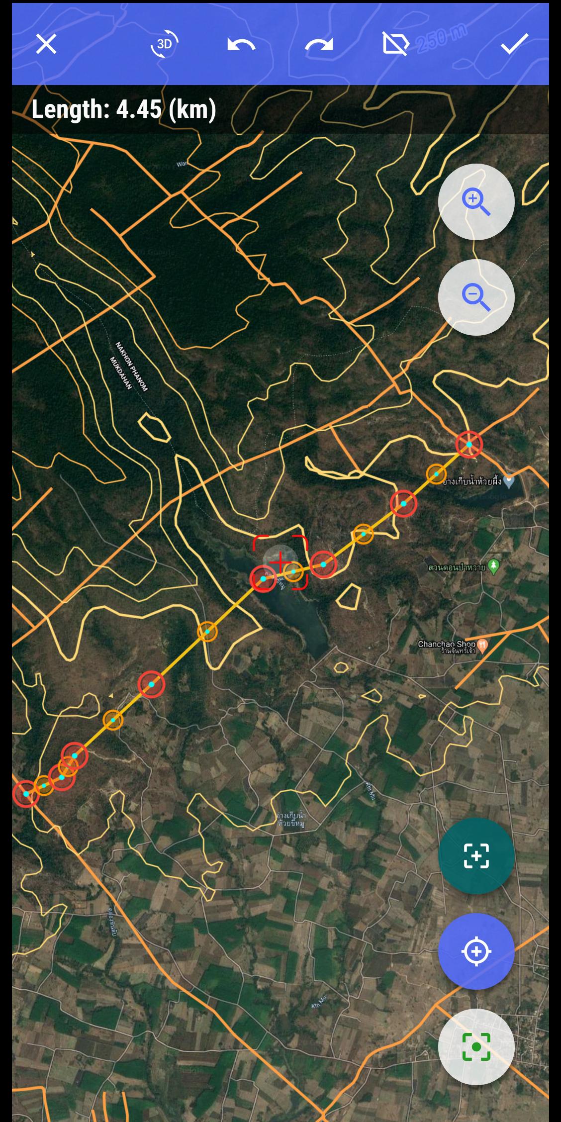
- Allows users to directly create objects (Points, Lines, Zones, Coordinate landmarks, Tracklog routes).
- Allows rapid measurement of the area and length of objects in the field.
- Users can simultaneously create Tracklog, create Point, Road, and Region at the same time while moving. Tracklog mode allows running in the background.
- Support to save attribute information and images in the field.
- Users can define forms, forms or fields to collect. And share quickly to the whole group via QR code or export to file.
- Find for waypoint, enter a list of waypoints from data TEXT(*.txt), Excel (*.xls, *.xlsx), CSV (*.csv) Excel and convert point coordinates directly on the device.
- Allow to enter the list of points to check by hand (For example, it is necessary to check the location of the extract of the red book).
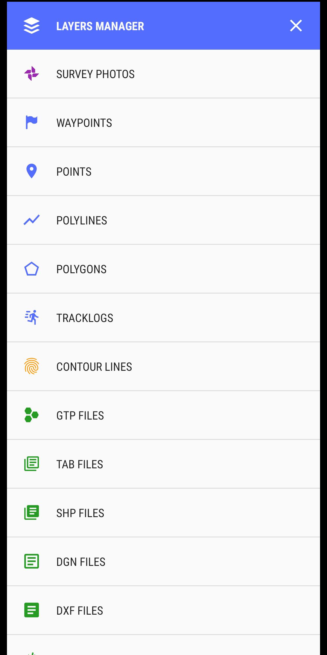
- Support directly opening common data such as Excel, GPS/GPX, KML/KMZ, GeoJSON, AutoCAD DXF, MicroStation DGN, ESRI Shapefile SHP, MapInfo TAB, gCadas GTP
- Support export data to GPX, KML, GeoJSON, Excel, AutoCAD DXF, MapInfo TAB, Shapefile SHP format and share via Email, Drive, Zalo, Facebook etc.
- Fully support the VN 2000 projection system of the local and nationwide of Vietnam.
- Support more than 5000 projection systems of other countries and territories in the world.
- Support for old projection systems like Hanoi 1972 (HN 72).
- Support numerical compass feature
- Support reading offline map data MBTiles and intelligent management of data layers.
- Support with simple MBTiles convert tool on Desktop, help to view properties directly from MBTiles layer.
- Support conversion of TCVN3, VNI encoding for Vietnamese font in viewing attribute information.
- Support field photography, save location, shooting direction on images and Exif information, GeoTag
- Allow users to download Google, MapBox, Bing, ESRI, OSM directly on the computer for offline use.
- Support web map service TMS and WMS.
- The feature allows users to directly find and use Landsat 8 satellite image data (16-day update cycle) and Sentinel 2 (5-day update cycle) from the image database.
If you need assistance please contact us at the following information:
Facebook: https://www.facebook.com/vToolsForMapInfo
Email: [email protected]
Phone (Zalo): (+84) 96 990 4596
All Rights Reserved. Copyright © 2020
Last updated on Oct 29, 2020
Update version v4.1.2
- Update the information entry form interface
- Some minor changes to the interface for layers manager
- System optimization
En Son Sürüm
![]() 4.1.2
4.1.2
Yükleyen
Lazarus M Nzomo
Gereken Android sürümü
Android 6.0+
Kategori
Bildir


Discover what you want easier, faster and safer.
")
vTools for Survey (Free)
4.1.2 by vTools Apps
Oct 29, 2020