下載 APKPure App
可在安卓獲取OilTrails的歷史版本
Oil and Gas Well Locator - Oilfield Navigation, Well Data, and Weather
*OilTrails requires a subscription, but new subscriptions come with a 1 month, no obligation, free trial.
Find oil and gas locations across the US with ease. Get turn-by-turn directions, view well data, weather forecasts, drop pins to see location name, and share well info and location coordinates with OilTrails. The only app that combines all these features with a simple yet powerful interface.
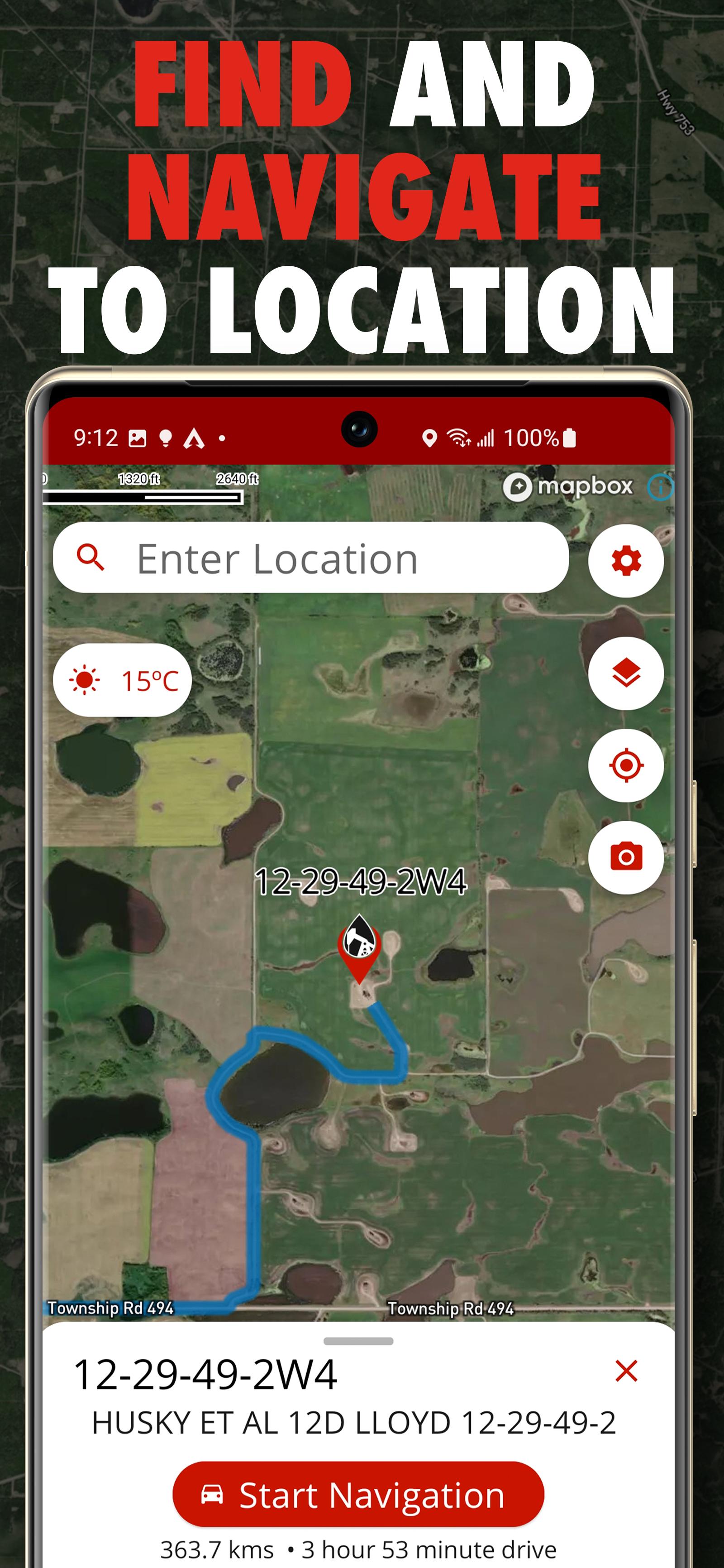
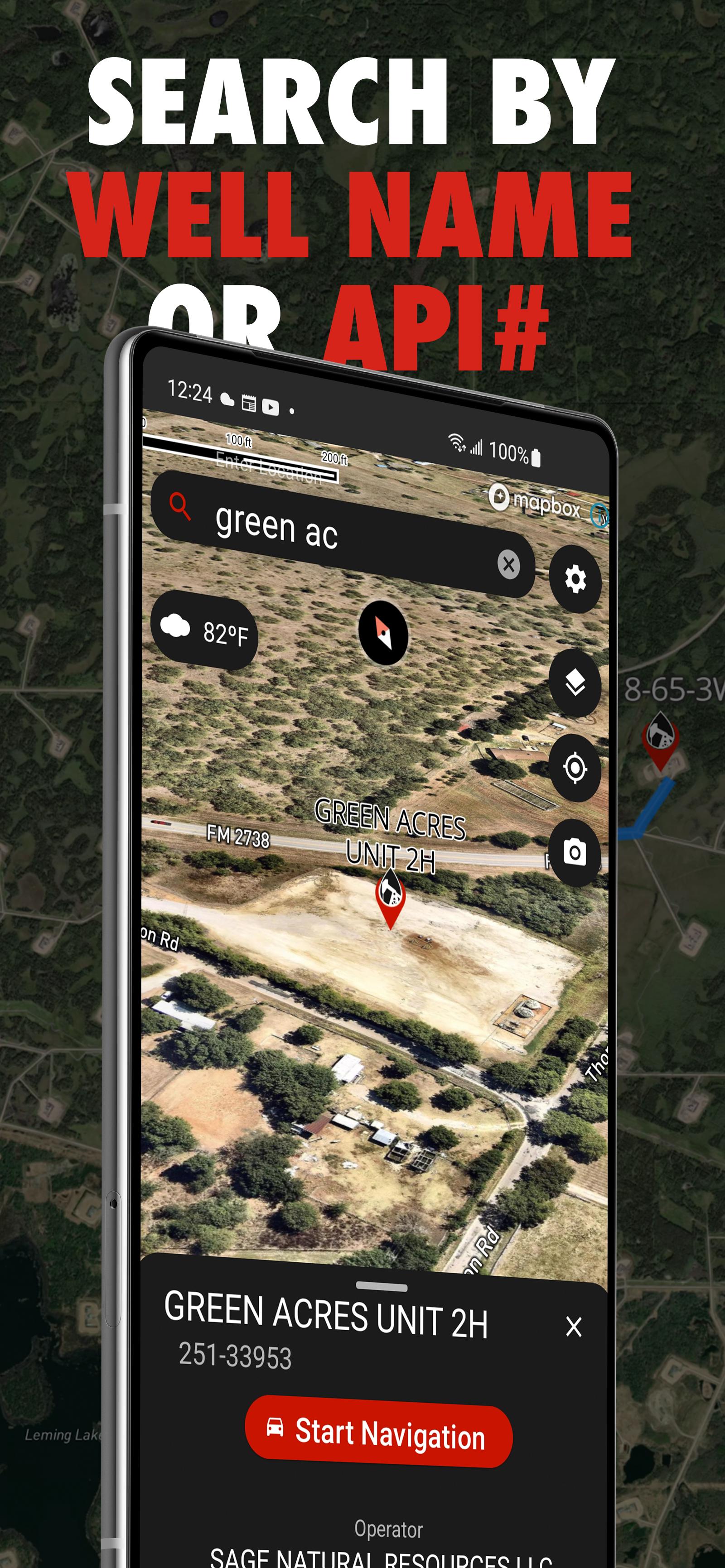
This multifunctional lease locator app makes getting to work in the oilfield a breeze. Simply enter the legal land description, name, or API number to view the surface location OR drop a pin on the map to view location and well info (if vertical). The location can be opened in Apple or Google maps for turn by turn navigation. Change the origin location to see step-by-step directions to location from the nearest town, useful for putting together ERPs or providing visitors directions.
No cell service? No problem. As long as turn by turn navigation is started before service is lost, the directions will continue to function so you don't have to worry about being stranded halfway to location.
Enter a location and view well information such as the operating company, depth, drill date, current status, downhole fluid, formation, and more. Data varies depending on the region.
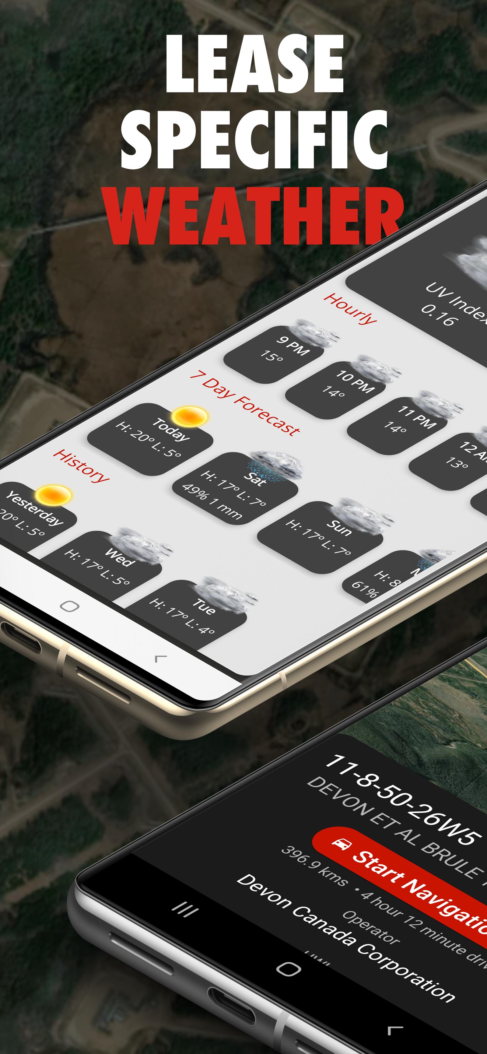
See the current, future AND past weather specific to the location entered. Wondering if the lease is too wet or has snow to be cleared? View the precipitation the location was forecasted to receive in the past three days. Scroll for 48 hrs of hourly forecasts, 7 daily forecasts, and previous forecasts.
Drop a pin on the map to see the location and well info for that location.
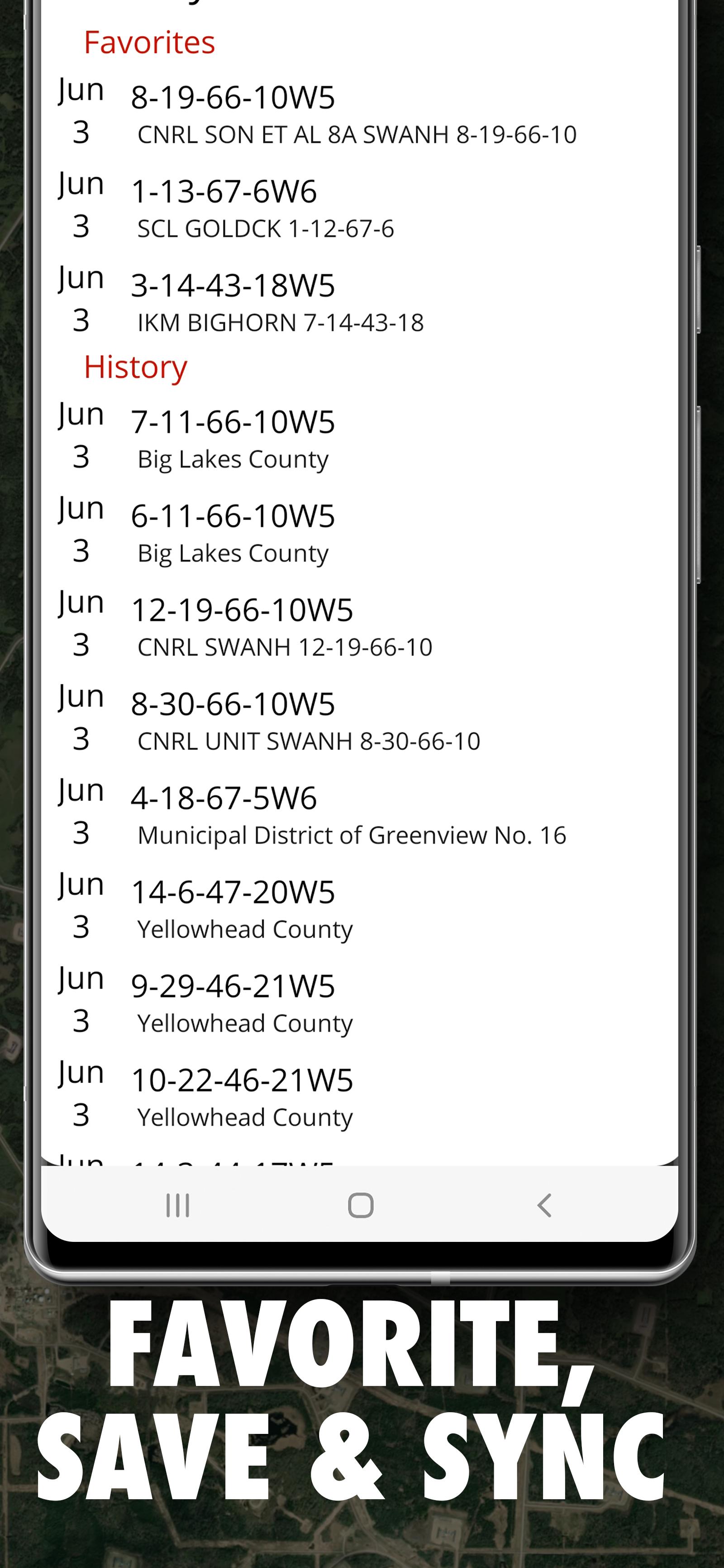
View history of past locations viewed and date they were looked up. Makes driving logs and reports a breeze by knowing where and when you were. Create an account to save and sync locations between devices.
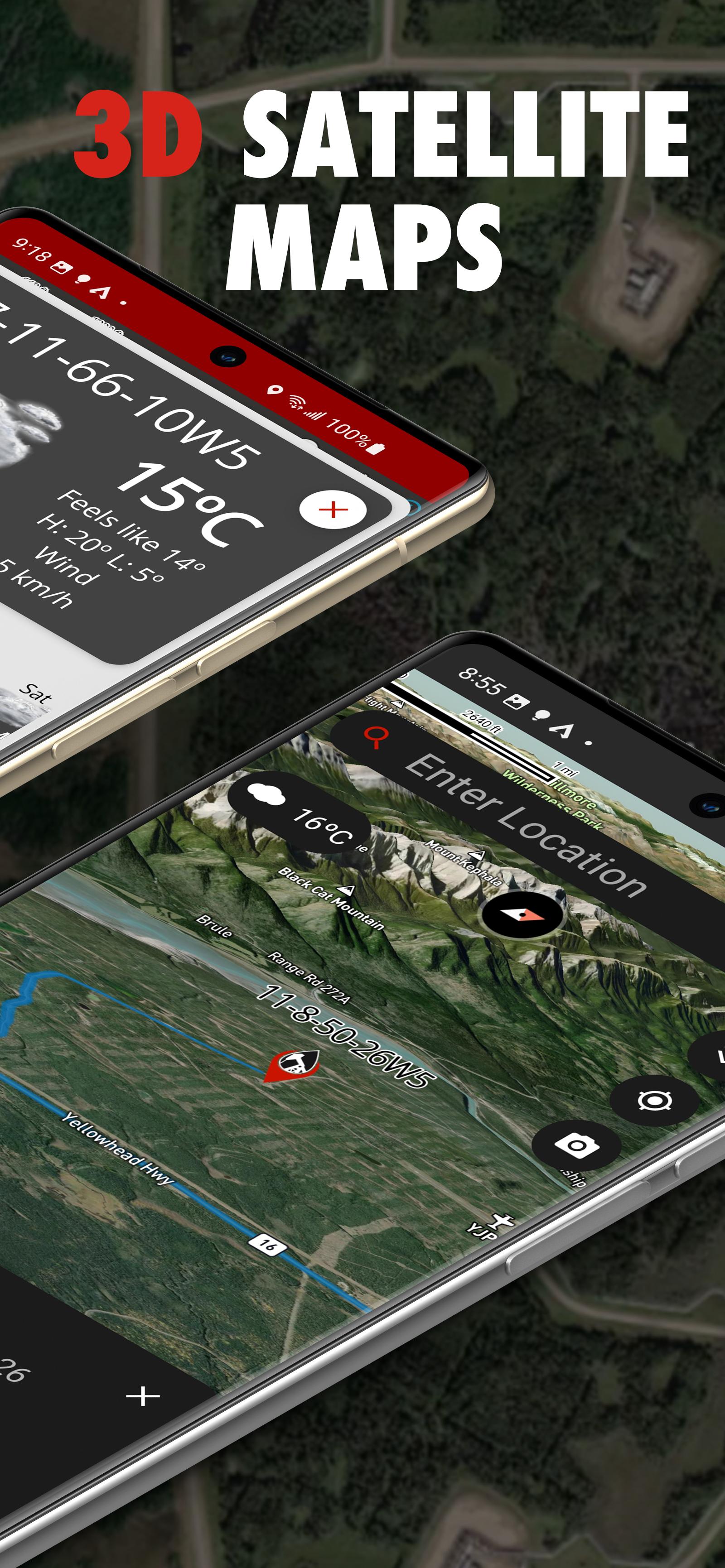
Maps can be shown in a variety of ways including Topographical, 3D Satellite, 2D Satellite, Dark Roads, and Light Roads.
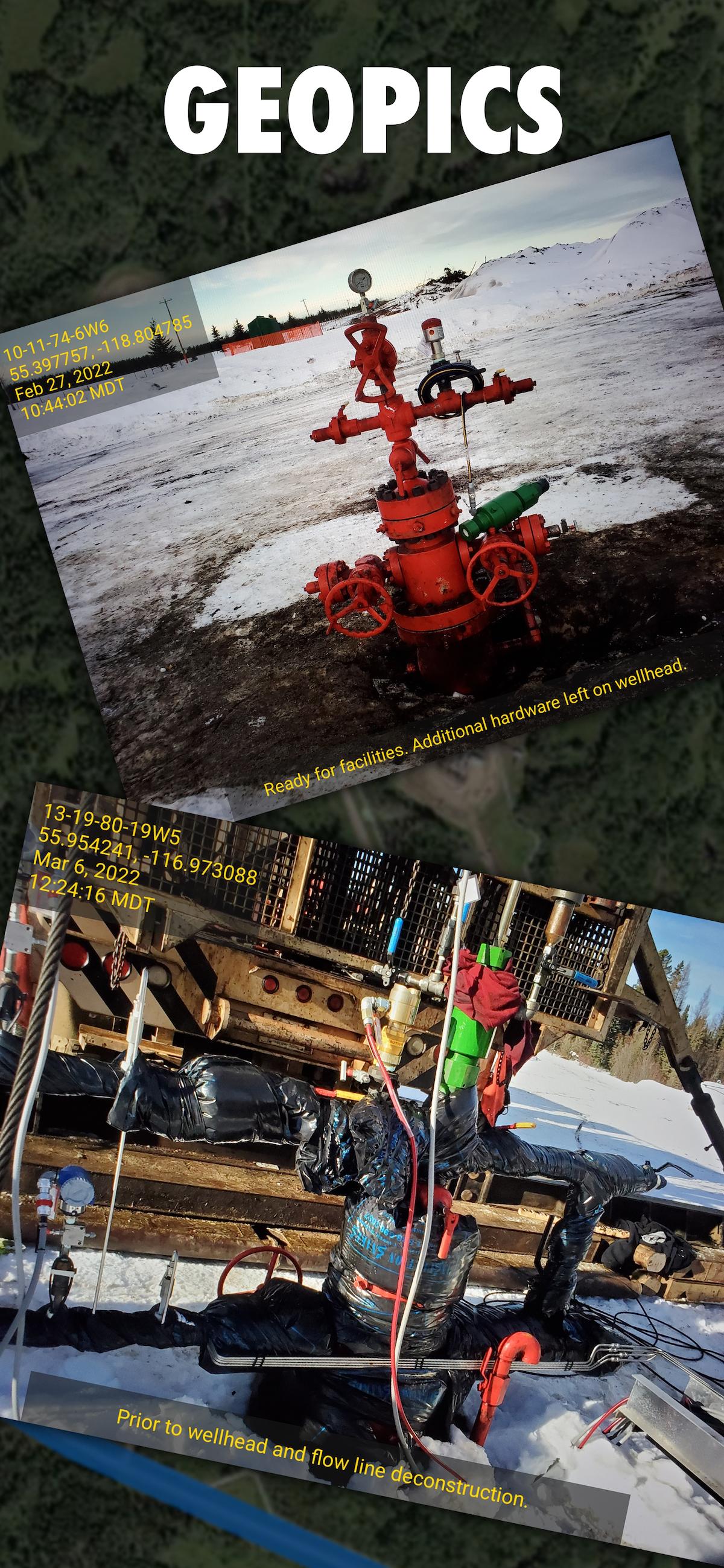
Take GeoPics, geographical and date/time stamped photos that you can save to your device or share.
-Turn by turn GPS navigation in Google Maps
-Enter downhole location to view well info such as the operating company, depth, drill date, current status, -downhole fluid
-View the current weather at location as well as hourly and daily forecast AND previous forecasts to see if the location has received rain/snow is the past three days
-See location in app and view with standard, hybrid, or 3D satellite imagery
-Store history of previously viewed wells/locations
-Share location and well info via message
-Drop pins on the map to see that location's LSD and well info
-International support, find wells in the United States and Australia
Last updated on 2024年08月06日
-Added in-app turn by turn navigation
-Updated the user interface to remove some of the red accents.
-History cells now display the date searched on the right side
-Made several tweaks to improve weather-related features and functionality.
-Introduced cross-platform subscriptions, allowing you to access your subscription from other platforms seamlessly.
-Added well data for British Columbia (BC) and Saskatchewan, expanding our coverage and providing more comprehensive data.


OilTrails
2.2.003 by Ash Point Software
2024年08月06日