APKPure에서 안전하고 빠른 APK 다운로드
APKPure는 바이러스 없는 ESA ers APK 다운로드를 위해 서명 확인을 사용합니다.
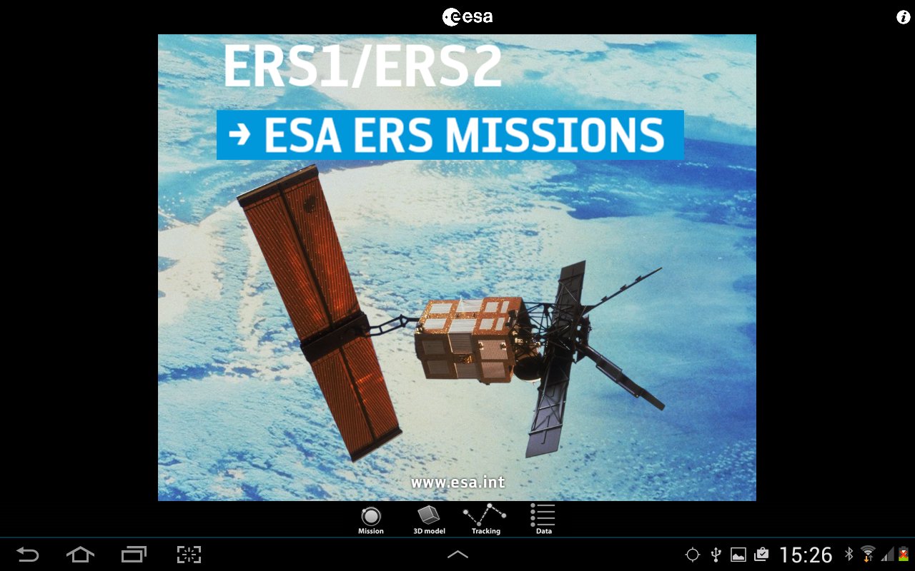
ESA의 ERS는 유럽의 원격 탐사 위성 ERS-1과 2에 대한 ESA 공식 응용 프로그램입니다.
ESA's two European Remote Sensing (ERS) satellites, ERS-1 and 2, were launched into the same orbit in 1991 and 1995 respectively. Their payloads included a synthetic aperture imaging radar, radar altimeter and instruments to measure ocean surface temperature and wind fields.
ERS-2 added an additional sensor for atmospheric ozone monitoring. The two ESA satellites acquired a combined data set extending over two decades.
This application is a gateway to knowing what the ESA mission is about, how it works and what the elements of the space and ground segment that makes this mission unique are.
It includes also a dedicated section that allows one to discover and visualize optical measurements over our planet.
Features:
- Description of the ESA ERS missions: space and ground segment
- Large selection of photos and videos on a wide range of topics related to ERS missions
- Striking ERS 3D models with explanations of the different platform and payload elements
- World map with orbit position of the ESA satellite
- Satellite visibility over selected ground stations and local position
- Impressive visualization of ESA ERS measurements over the Earth with vertical profiles and with acquisition strip over the earth
- Access to several geophysical parameters measured by the satellite
…and much more
In the 3D environment:
- swipe/pinch to rotate/zoom the scene or the satellite model
- triple touch to reset position
In the Data ATSR (Optical) section:
- Zoom the bottom map image by pinching two fingers in or out and drag it with one finger
- The center of the blue cross is a pointer to an optical data value of the selected variable, in a specific point (Latitude/Longitude) at a specific date time
- Position the optical stripe at the center of the map and watch the cursor move above the earth surface


등급과 피드백에 감사드립니다!
당신은 이미 평가했습니다.