APKPure에서 안전하고 빠른 APK 다운로드
APKPure는 바이러스 없는 Satfinder - Satellite Director APK 다운로드를 위해 서명 확인을 사용합니다.
SatFinder (Satellite Finder) Geo area calculator and Level meter
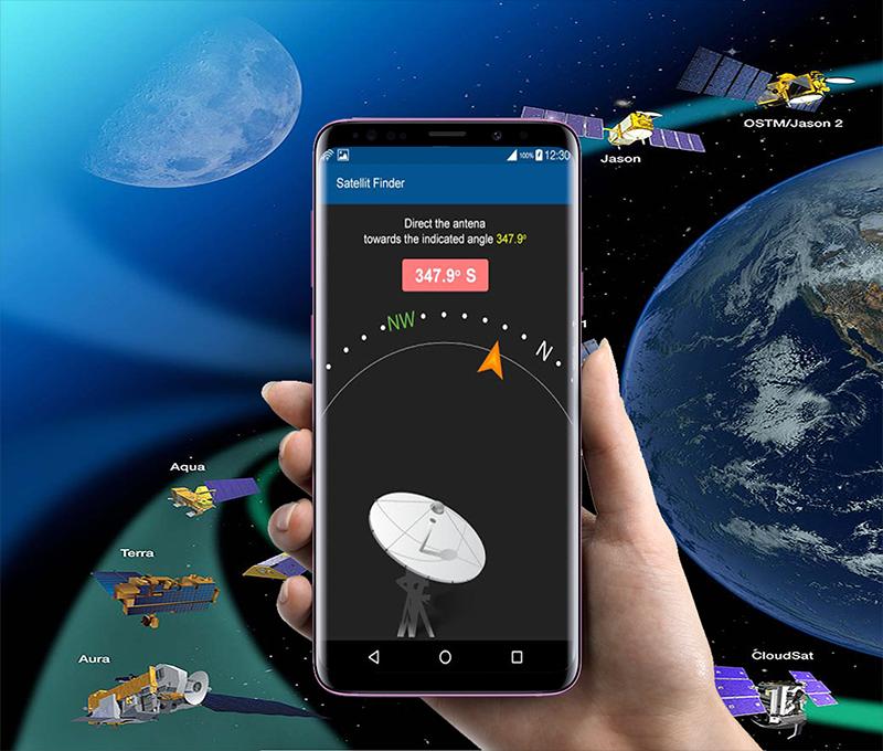
SatFinder (Satellite Finder) Geo area calculator and Level meter is a tool which will help you to set up satellite dish. It will give you azimuth, elevation and area calculation for your location (based on GPS) and chosen satellite from list. The result is shown both as numeric data and graphical on google maps. It has also built in magnetic compass which will help you to find proper satellite azimuth.
Finding a TV satellite or an antenna, in azimuth can be pretty difficult. Before you can find it with a compass you have to do some calculations using GPS location, magnetic variation, compass azimuth and satellite azimuth.
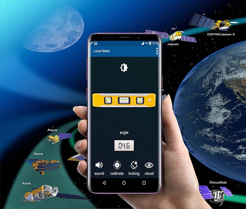
Bubble Level – Inclinometer
Best Level functioning the same as its real physical equivalent (also known as libella, spirit level or bubble level). Using it you can easily check if the measured surface is truly flat. An inclinometer or clinometers is an instrument for measuring angles of slope (or tilt), elevation or inclination of an object with respect to gravity. It is also known as gradient meter, gradiometer, level gauge, level meter, declinometer, and pitch & roll indicator, quick satfinder, satellite detector, satellite finder, satellite direction, ISS Detector Satellite Tracker,
satellite director dish & satfinder app.
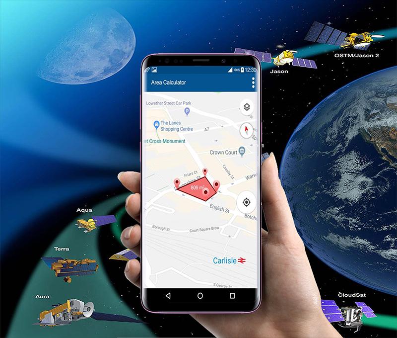
Geo Area Calculator For Land
Field area measurement app is a free area distance and perimeter measurement app also referred to as GPS area calculator for land measurement,to measure area on map, or platometer and is used to measure field areas, collect ground samples, GIS surveys. This app act as fast area distance marking
Features Of Satfinder (Dish Pointer) Area Calculator:
- Satellite view above your location where to point the dish
- More Than 150 Satellites available worldwide
- vibrate on finding exact direction
- Display your location and all satellites the values for: azimuth, elevation
- Accuracy of measurement with Bubble Level
- 3 different display modes of Level Meter
- Spirit Level, bubble level, electronic level, laser level, nivel, plumb bob, level tool, clinometer, leveler, protractor, inclinometer, carpenter's level
- High Accuracy with fast area and distance marking
- Land Based Surveys
The satellite list is complete and includes all television satellites, so the app should work worldwide.
Important Note: Compass works only on devices with compass sensor (magnetometer).


등급과 피드백에 감사드립니다!
당신은 이미 평가했습니다.