Package Name:com.seavectors.android
Show More


19.5 MB
File Size
Everyone
Android 7.1+
Android OS
NOAA ENC nautical charts, Relief shading, offline charts, AIS, tides, NMEA, GPS
SeaVectors is professional marine navigation for boaters: official CHS and NOAA ENC nautical charts, detailed relief shading, high-res satellite images, offline chart downloads, live marine weather, official tides and currents, AIS collision awareness and your boat's NMEA instruments — in one boat GPS app.
Everything you see is built on official ENC chart data. This isn't a street map with water on it.
OFFICIAL ENC NAUTICAL CHARTS
Full NOAA ENC coverage for the United States plus high-definition vector charts for the Canada West Coast, built from the S-57 standard and drawn with S-52 symbology — the ECDIS presentation used on ship bridges. Vector charts stay sharp at any zoom.
• Nautical, City Details, Relief Shading and Satellite base maps
• Boat-specific safety contour and safety depth
• Point the crosshair at a wreck, rock, light or buoy to see its name, depth and light characteristic, or tap any object to read its official attributes
• Toggle depth areas, contours, soundings, hazards, aids to navigation, cables, restricted areas and labels — your choices are remembered
RELIEF SHADING
Our most detailed seabed and coastline relief shading, precise and built from the latest surveys: 3 m on Canada's West Coast, 1 m on the US West Coast, and 1–2 m on the US East Coast and Florida, including its Gulf Coast. See channels and shoals as they lie.
OFFLINE CHART DOWNLOADER
Move the chart to pick an area, see its size with or without Relief Shading, and save it before you leave the dock. Areas download one after another while you keep using the app, overlaps are never downloaded twice, and saved areas work with no signal.
BOAT GPS AND NAVIGATION
Position, COG, SOG and charted depth under the boat, live in the nav bar, with locate, follow and course-up 3D tracking. Speed in knots, mph or km/h; depth in feet or metres; temperature in °C or °F.
CONNECT TO YOUR BOAT — NMEA 0183 AND NMEA 2000
Join your boat's network over Wi-Fi for live speed, depth, wind, heading, position, RPM, fuel and more, across multiple engines, tanks and batteries. Build your own instrument dashboard from two dozen widgets. No proprietary hardware required.
AIS COLLISION AWARENESS
See nearby AIS vessels with CPA and TCPA. Configurable thresholds, colour-coded risk, flashing warnings and audible alarms flag a developing collision risk early.
TIDES AND CURRENTS FROM CHS AND NOAA
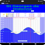
Official Canadian Hydrographic Service and NOAA stations sit directly on the chart: current speed and direction, flood, ebb and slack, tide height and the next highs and lows — the timing that matters in channels and tidal passages.
MARINE WEATHER ON THE CHART
Animated rain, temperature, wind, gust, wave, tide and current overlays, plus a forecast that lines up every category on one timeline. Choose automatic, NOAA NWS or Environment Canada models, and download 14 days of forecasts for your trip area before departure.
ROUTES, TRACKS AND MARKERS
Plan multi-leg routes with distance, ETA and fuel estimates, see the forecast for when you'll reach each point, and preview them with route simulation. Turn a distance measurement into a route in one tap. Record and replay tracks, and mark spots with notes, photos or video.
ALERTS FOR RESTRICTED AREAS AND FISHING CLOSURES
Get alerted near charted Restricted Areas and supported DFO fishery closures in British Columbia, and read the actual rule before you drop a line.
MARINE SEARCH
Find marinas, anchorages, fishing spots, stations, and your own routes and markers.
Weather, tides, currents and crosshair chart readouts are available in English and Simplified Chinese.
WHO IT'S FOR
Coastal cruising, sailing, sport fishing, kayaking and small-craft professionals — anyone who wants a real ENC chart and their boat's data on one screen.
SeaVectors aids navigation. It does not replace official paper charts, a proper lookout, or prudent seamanship.
Terms of Service: https://seavectorsapp.com/terms/
Privacy Policy: https://seavectorsapp.com/privacy/



One-click to install XAPK/APK files on Android!

Thanks for your rating and feedback!
You have already rated.