Safe & Fast APK Downloads on APKPure
APKPure uses signature verification to ensure virus-free IWB Mobile APK downloads for you.
Effective flight planning, information, flight zones and weather data
The application is based on the IWB system used for remote check-in, flight preparation and FPL service. The mobile version enables efficient IWB operation on mobile devices and includes aviation data to increase flight operational efficiency and pilot situational awareness.
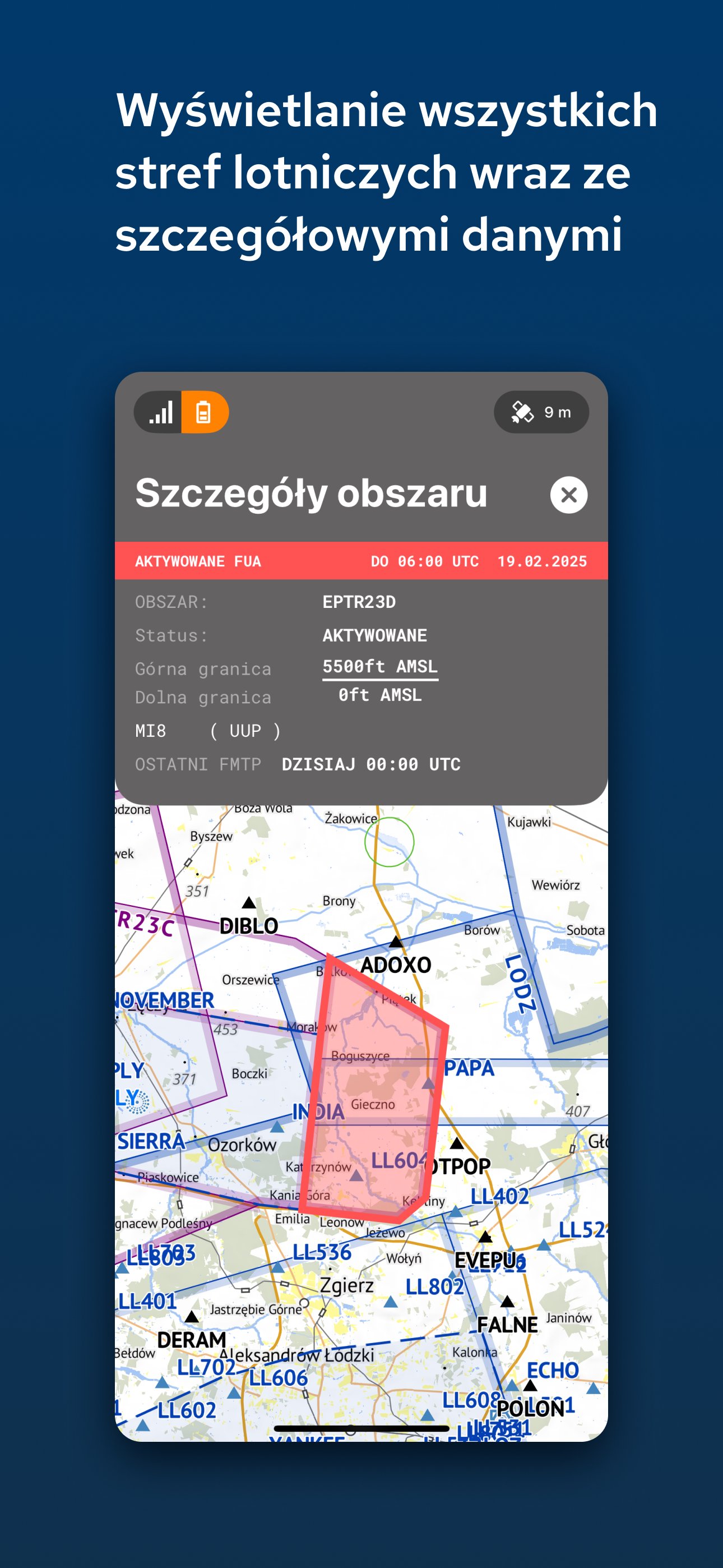
Application functionalities include, among others: transmission of static and dynamic airspace data, handling the list of flight plans and planned operations, viewing NOTAM and METEO data, and viewing planned and active air zones.
Considering that the portable on-board device and the data provided provide only general information, the application cannot be treated as a source of data critical to the safety of the flight operation.
Only registered users are entitled to use the IWB Mobile application, not exclusively, but with other registered users, without transferring the right of use.
The IWB Mobile application may only be used for private purposes in accordance with the terms of use. Use for business purposes is prohibited.
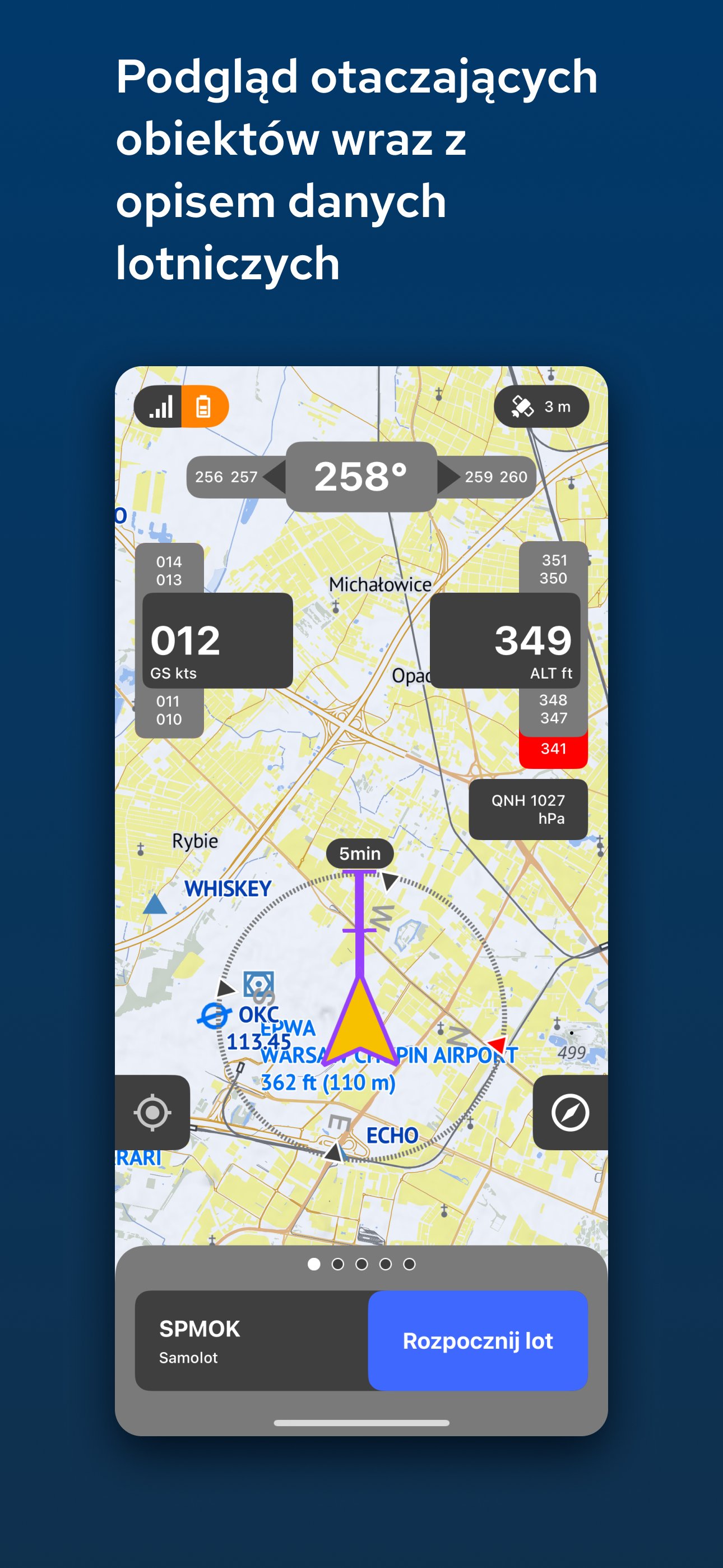
Note: Location allows you to view a moving map, share position information with the system, and record route logs.
MAP
Basic day and night maps of Poland for offline navigation.
Polish DDM-50 topography - digital terrain model (50 x 50 meter grid) available offline. Terrain data calculates the minimum altitude of relevant GNSS positions during flight.
AIRSPACE
Polish airspace contains offline static data, dynamic data (eFUA) and online data.
DIGITAL AERONAUTICAL DATA COLLECTION
EAD AIRAC updates (European AIS Database) and downloading data for offline work.
AERONAUTICAL INFORMATION and CHARTS
Access to information and aeronautical maps contained in AIP
METEOROLOGICAL DATA
Meteorological data such as radar precipitation, visible satellite images and forecasts are regularly downloaded from the server by the application based on their validity and when the data was last updated.
PLANNING
You can view and use your planned flight operations saved in the IWB (web) system.
FLIGHT PLANS (FPL)
A database containing a list of active and archived flight plans along with their current status. The flight plan can be displayed on the map and the flight can be started from the flight plan list and route preview on the map. The user can send ARR, CNL, CHG and DLA messages to his flight plan.
ROUTES
The system creates and stores active flight paths.
VISIBILITY
The IWB mobile application sends GNSS position data (latitude, longitude, altitude, speed, vario, timestamp, accuracy) to servers via the mobile network to share, transmit and display it to other users on the mobile application.
Consent to sharing your current location and tracking data on the mobile app is part of the terms of use.


One-click to install XAPK/APK files on Android!
Thanks for your rating and feedback!
You have already rated.