Our website uses necessary cookies to enable basic functions and optional cookies to help us to enhance your user experience. Learn more about our cookie policy by clicking "Learn More".
Accept All Only Necessary Cookies
「距離測定」地図をタップで簡単 icon

2.3.0 by gacool


Jul 8, 2021

About 「距離測定」地図をタップで簡単

English

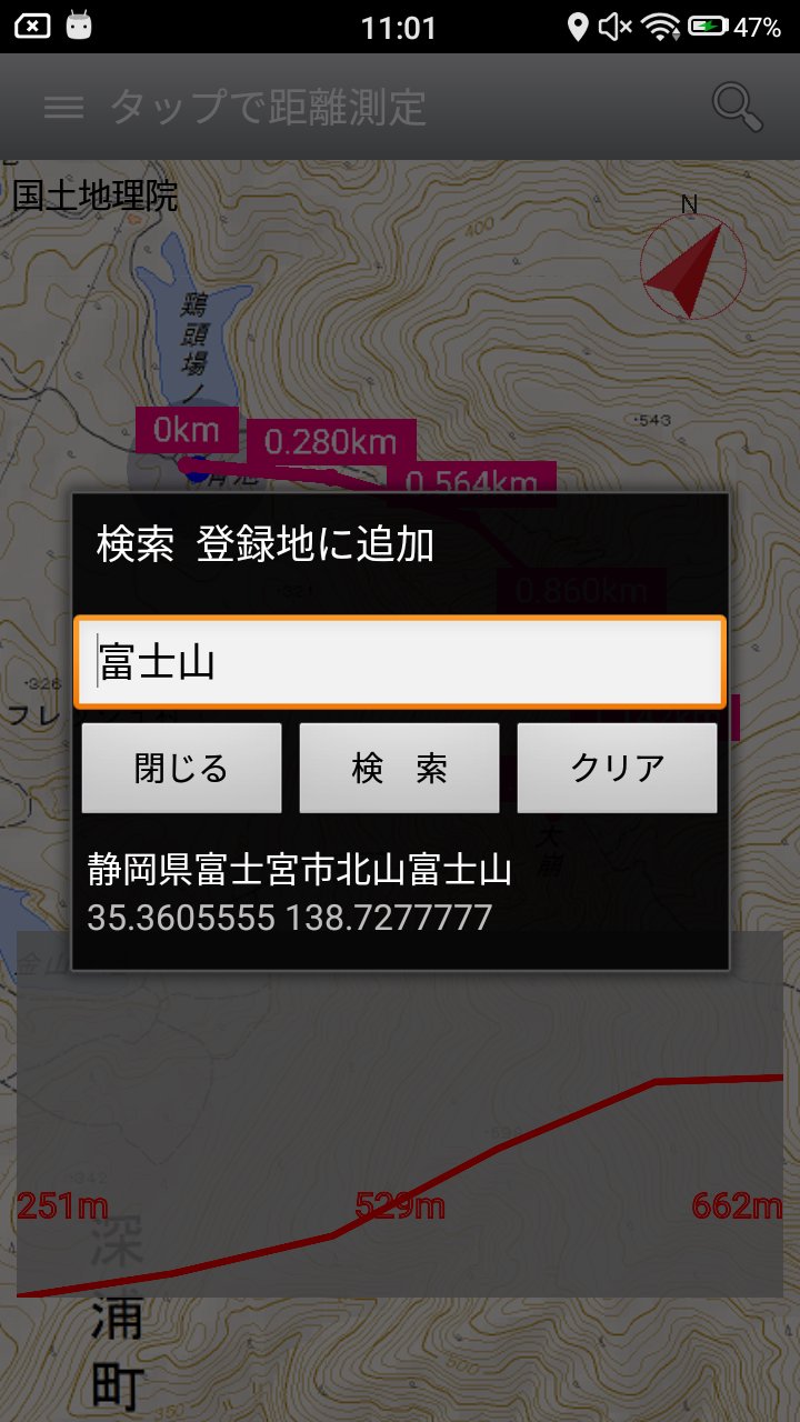
By tapping the map, measure the easy distance, you can save it as a GPX file.

1. 地図をタップすることにより、簡単に距離を測定できます。

2. 作成したルートは、GPXファイルとして保存できます。

3. 既存のGPXファイルの読込と編集ができます。

4. タップした地点の標高により、標高グラフを表示できます。

製作:susumu hirao

What's New in the Latest Version 2.3.0

Last updated on Jul 8, 2021

位置情報の使用目的を表示するダイアログを追加しました。

Translation Loading...

Additional APP Information

Latest Version

Request 「距離測定」地図をタップで簡単 Update 2.3.0

Uploaded by

Kinan Sabek

Requires Android

Android 5.0+

Available on

Get 「距離測定」地図をタップで簡単 on Google Play

Show More

「距離測定」地図をタップで簡単 Screenshots

Comment Loading...
Languages
Subscribe to APKPure
Be the first to get access to the early release, news, and guides of the best Android games and apps.
No thanks
Sign Up
Subscribed Successfully!
You're now subscribed to APKPure.
Subscribe to APKPure
Be the first to get access to the early release, news, and guides of the best Android games and apps.
No thanks
Sign Up
Success!
You're now subscribed to our newsletter.