Package Name:com.magpro.scanmap
Show More

Transform your phone into a professional 3D magnetic mapping station.
🔴 IMPORTANT NOTICE & LICENSING:
- NO EXTERNAL HARDWARE REQUIRED: 100% Standalone Operation. Uses only your smartphone’s internal magnetic sensor (magnetometer); no external antennas, probes, or additional hardware costs needed.
- FREE BONUS PC 3D SOFTWARE: Purchasing a "Lifetime License" in the mobile app grants full complimentary access to the professional Windows Desktop Analysis Suite (MagPro PC 3D Analysis)!
- FLEXIBLE LICENSING OPTIONS: Choose between an "Open Monthly Subscription" for seasonal field tasks or a "Lifetime License" for permanent one-time access.
- SYSTEM ARCHITECTURE NOTE: Integrated Bluetooth and Wi-Fi streaming is specifically designed to transmit live field data from your Android device to our Windows PC software console (Android-to-Android pairing is not supported).
━━━━━━━━━━━━━━━━━━━━━━━━━━━━━
Turn Your Smartphone into a Professional Subsurface Magnetometer!
MagPro Scan & Map: 3D Geophysics is an advanced engineering application that detects subsurface magnetic anomalies, structural void chambers, tunnels, and metallic bodies with laboratory-grade precision using your smartphone’s internal magnetometer.
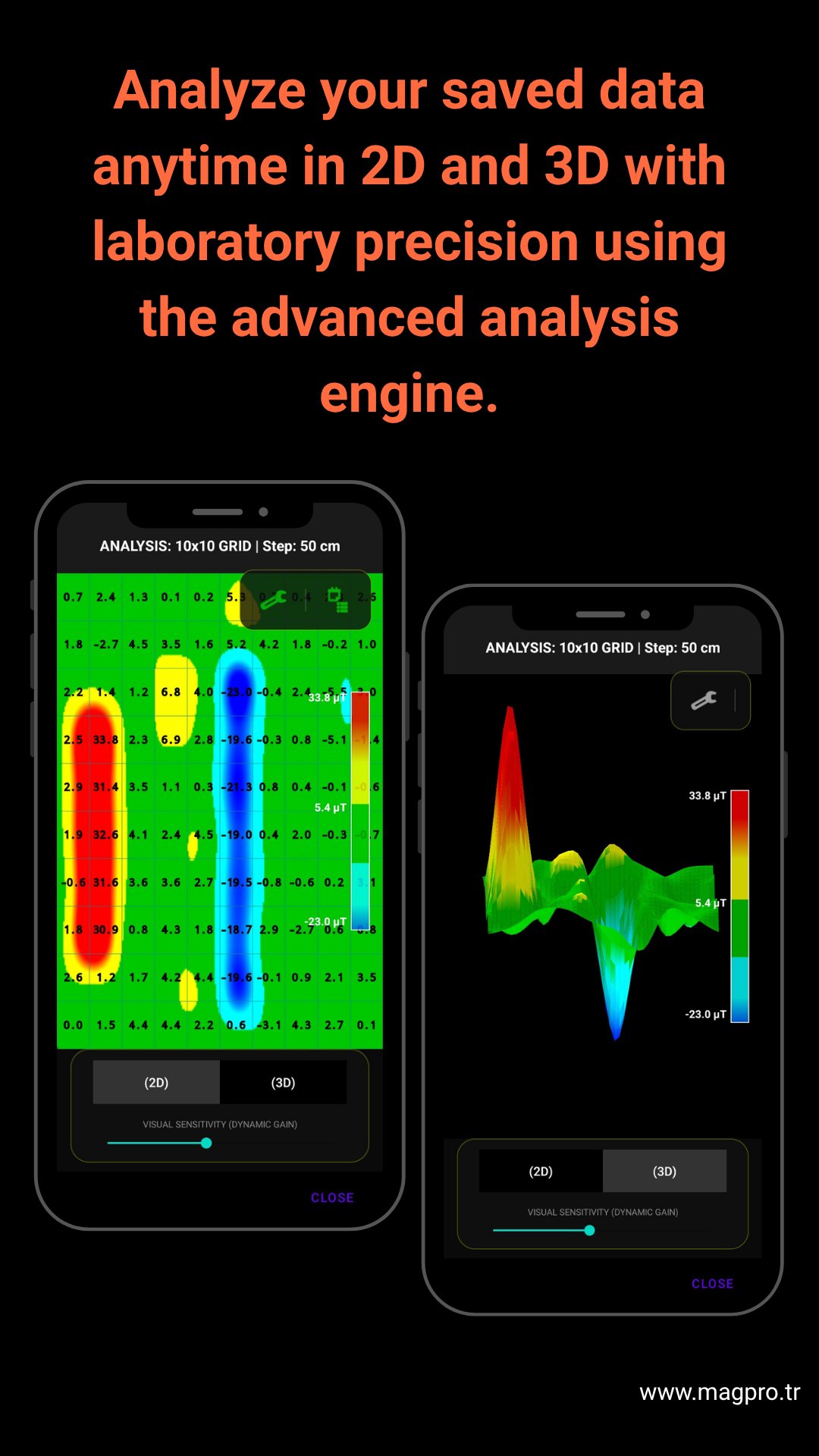
Transform field data into interactive 2D Heatmaps, 4D WebGL Volumetric Sections, and True 3D Isosurface Models directly on your device.
🚀 ADVANCED CORE ENGINES & NEW FEATURES
🤖 AI Subsurface Intelligence Report:
- Automated target classification (Ferromagnetic dipole, structural void, or mixed anomaly).
- Anomaly confidence score & mineral ground noise index calculation.
- Automated target center coordinates (X, Y) and estimated depth range calculation.
- Morphology strike orientation (North-South / East-West) and actionable field recommendations.
🧊 True 3D Isosurface Engine:
- Independent dual-threshold isolation for void chambers and metallic cores.
- Interactive 360° volume modeling with dynamic depth contours.
- Real-time threshold controls to strip surface clutter and highlight deep subtle targets.
🌐 4D WebGL Hardware Subsurface Scanner:
- Multi-layer subsurface cross-section and dynamic topographic grid overlay.
- Dual-slider threshold control to slice and dissect depth profiles in real-time.
⚡ FIELD & GRID MAPPING MODES
- Dynamic Grid Engine & Auto-Leveling: Real-time baseline ground balancing during live scans. Eliminates operator tilt error and mineral fluctuations.
- Bicubic Smoothing & Heading Correction: Eliminates walking zigzag artifacts and applies high-resolution interpolation.
- Trimmed-Mean Filter: Filters out internal hardware jitter and hand tremors, revealing smooth and deep negative void basins.
- LOGGER Mode (Time-Based Survey): Continuous recording with Bluetooth remote support for rapid large-scale field coverage.
- Metric Depth Calibration: Instant magnetic intensity, coordinates, and estimated depth readout for any touched point on the grid.
🛡️ PROFESSIONAL FIELD UTILITIES
- 100% Offline Architecture: Perform full surveys, 3D renderings, and AI reports in remote areas with zero internet connection.
- Local Privacy: Survey data is never uploaded to remote servers; all scans are processed and stored strictly on your local device.
- Comprehensive Reporting: Export high-resolution engineering PDF reports and raw CSV matrices for third-party geophysical software.
⚠️ TECHNICAL REQUIREMENTS:
- Your device must have a built-in magnetometer (compass sensor).
- Compass calibration is recommended prior to surveying. Keep the device at a steady 30–45 cm clearance from the ground during sweeps for optimal results.
📬 Support & Contact:
- Email: [email protected]
- Web: www.magpro.tr





One-click to install XAPK/APK files on Android!

Thanks for your rating and feedback!
You have already rated.