Package Name:app.moodsailor
Show More

Your waypoints. On the horizon. Offline charts, traces, weather, free.
moodSailor is a nautical navigation app for sailors, boaters, kayakers and anyone who spends time on the water. It works offline, runs on your phone, and respects your privacy.
NAVIGATION
- Man overboard: MOB button on every screen, alarm, bearing and drift area
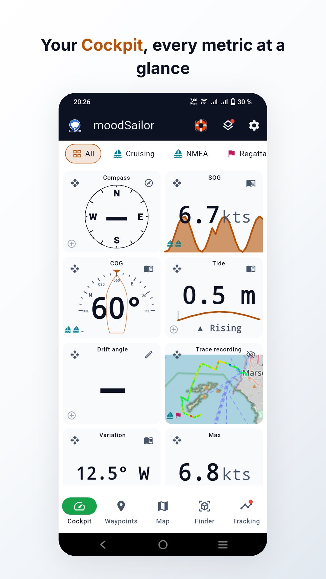
- COG, SOG, max and average speed
- Distance travelled, current GPS position, magnetic heading
- Compass: fixed or rotating mode
- Head-up course-over-ground compass
- Reorderable metric cards
- Custom cockpit panels: your cards, your sizes
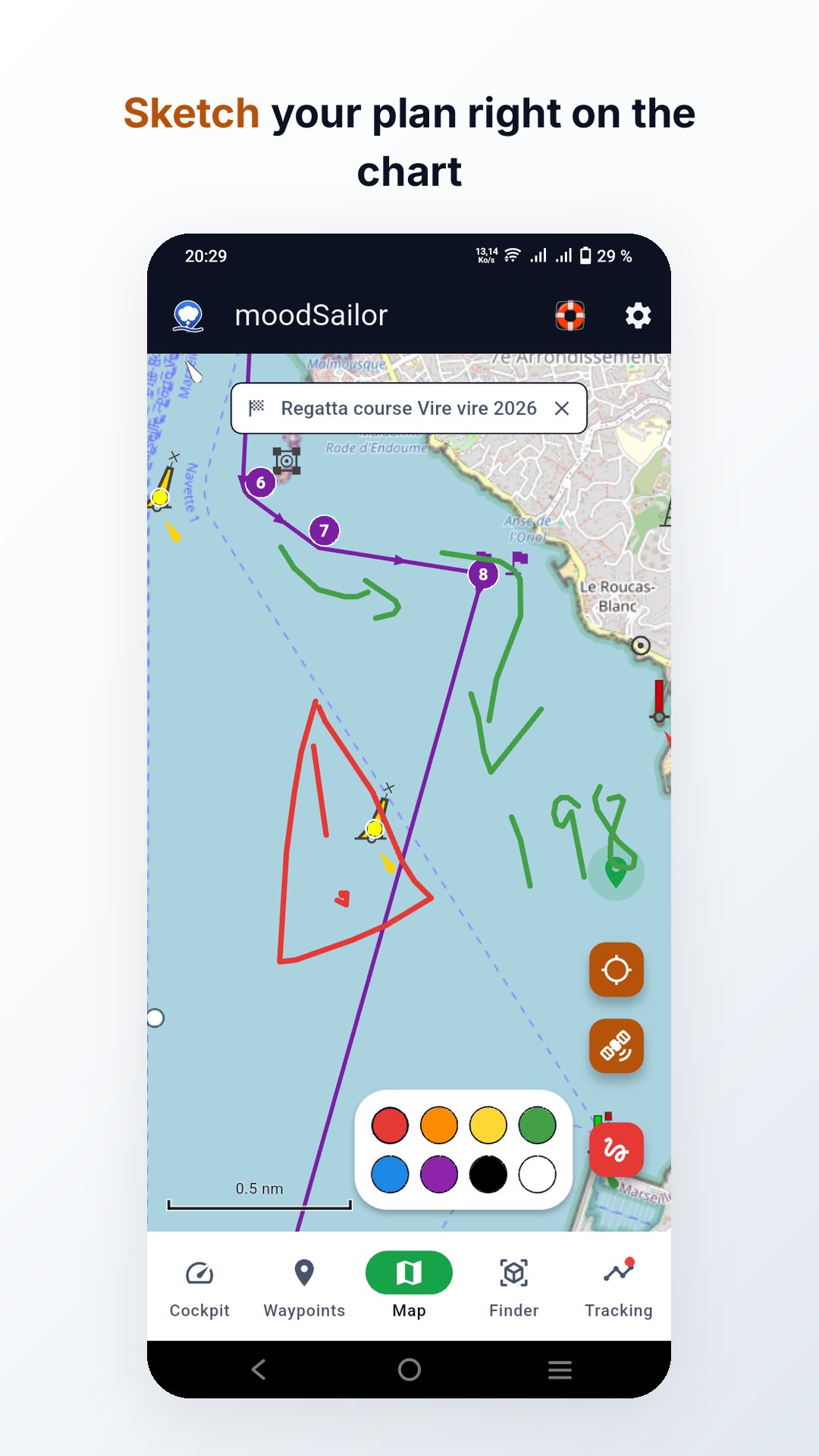
- Regatta mode: course marks, start sequence with flags and countdown, over-early alert
- Signal K and NMEA instruments on the cockpit: heading, depth, wind
- TVMDC calculator, units converter and IALA region card
MAP
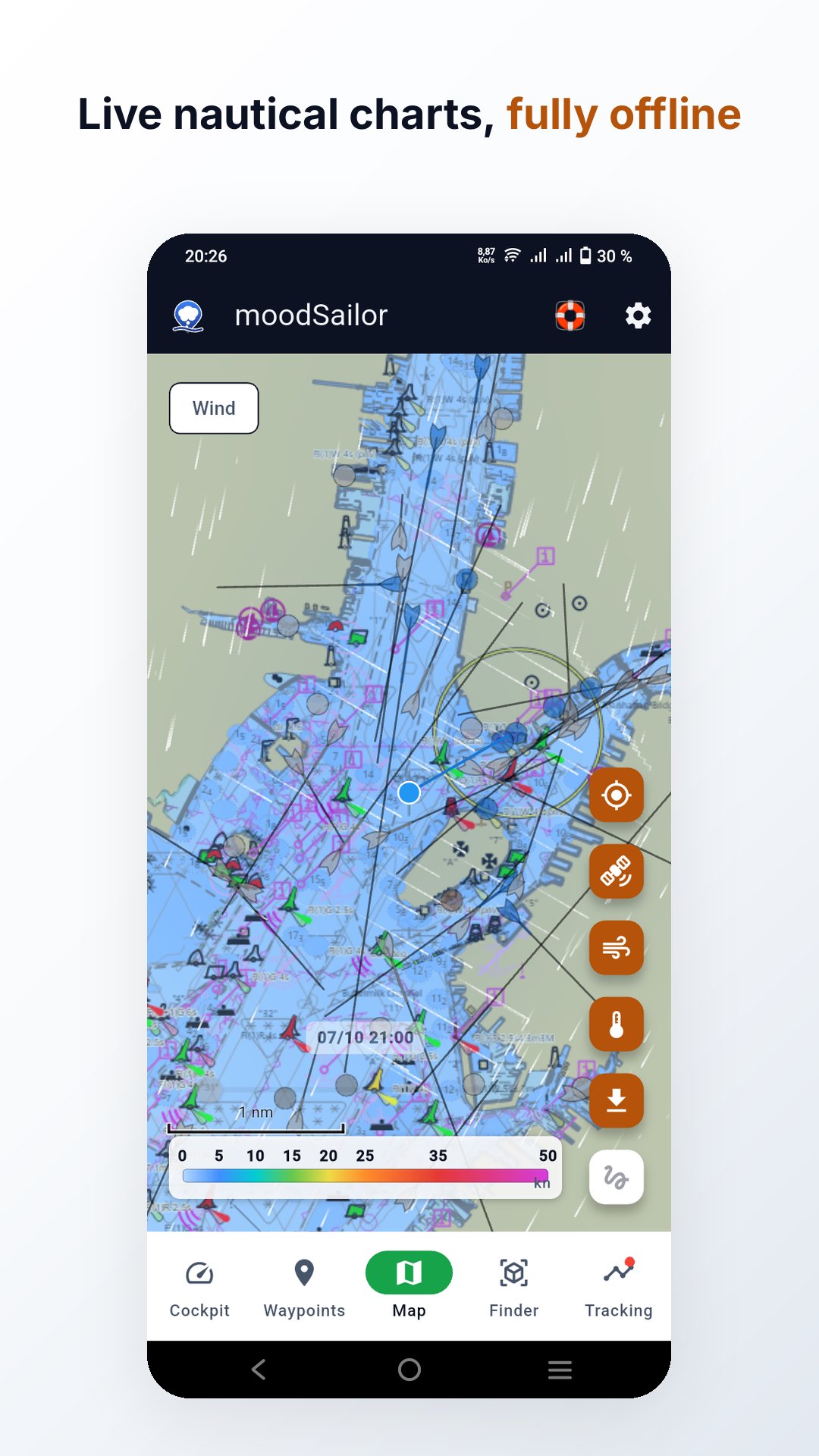
- OpenStreetMap base layer with OpenSeaMap nautical chart overlay
- Official charts where a hydrographic office publishes one free: Norway, US, Canada, Iceland, Netherlands, Spain
- Offline tiles: pick area, layers and zoom
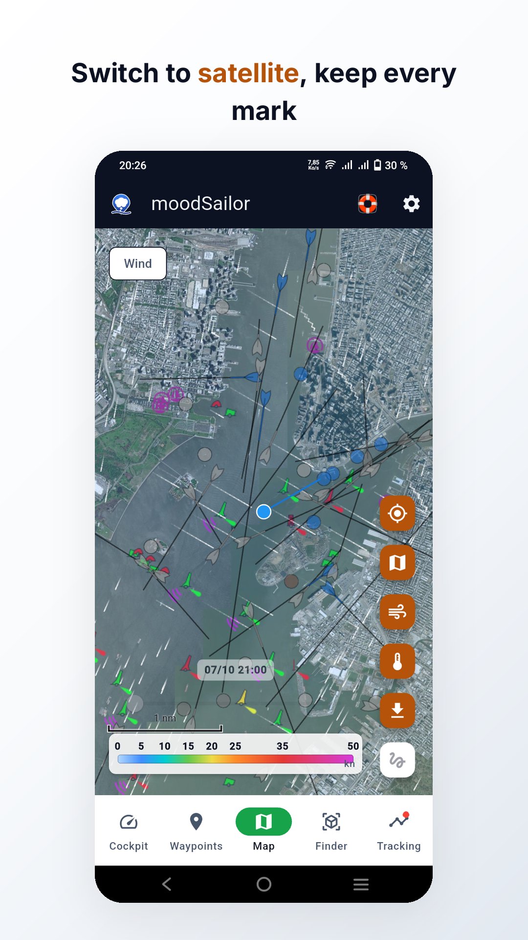
- One-tap Map/Satellite view switch
- Adjustable overlay opacity
- Download tiles, weather, marine data and marks
- Three rotation modes: north up, COG-aligned, compass-aligned
- Follow mode with position marker and heading line
- Route tool: draw, measure, save multi-leg routes
- Sketches: draw freely on the map in eight colours, save by name, export as KML or GeoJSON
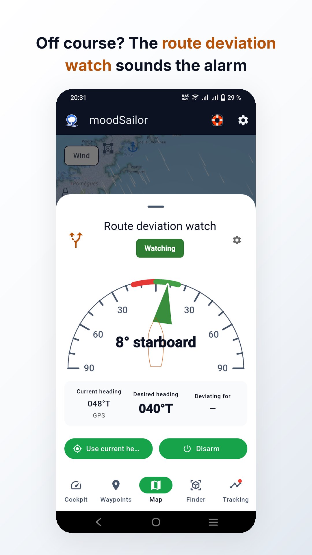
- Route deviation watch: alarm when your heading leaves the course, even with the screen off
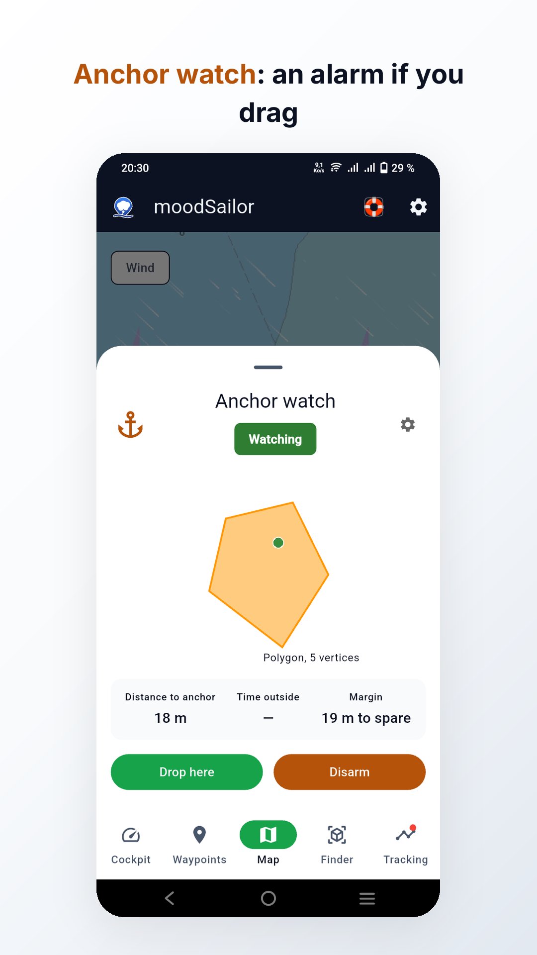
- Anchor watch: circle or polygon around the drop point, alarm if the boat drags
- Navigational warnings: French AVURNAV, Canada, Croatia and relayed authorities
WEATHER, CURRENTS AND TIDES
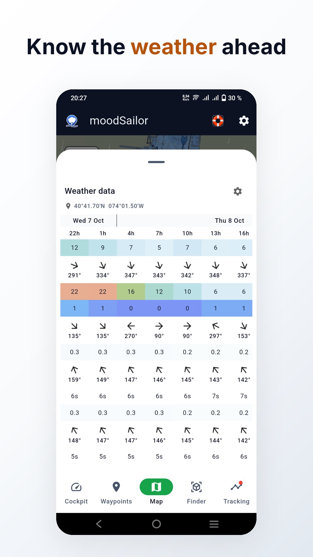
- Wind, ocean currents, waves and swell from Open-Meteo
- Wave and swell height, direction and period
- Choose the forecast sheet's weather fields
- Animated particles or wind-barb arrows
- Smooth heatmap with colour scale
- Forecast time slider
- Tide curve integrated in the sea-level row
- Every recorded GPS point carries its weather, currents, waves and tide
GPS TRACES
- Recording interval: 1, 2 or 5 seconds
- Background mode: keeps running with screen locked
- Live trace coloured by speed
- Resilient to GPS dropouts
- Battery guard (Android); native location manager (iOS)
- Editor: mini-map, altitude graph, weather, currents, tide
- Six denoising rules
- Import via "Open With" from Files, Mail
- Export to GPX, GeoJSON, CSV or KML
POINTS OF INTEREST
- Create, edit and delete POIs
- Nautical marks: the full IALA set, incl. wreck and preferred channel
- POIs on the map with type-specific icons
- Mark detail pages: light rhythm, cardinal topmark
- Lit marks flash their real light rhythm on the map
- OpenSeaMap nautical marks: download as POIs, search by signal code
- Export points, seamarks or your position as GPX, KML, CSV or GeoJSON
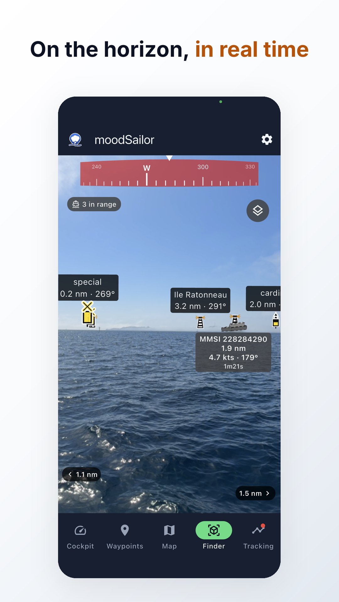
AR POI FINDER
- Live camera with augmented-reality POI markers
- Compass ribbon with cardinal labels
- Configurable distance range and marker size
- Immersive full-screen mode
- OpenSeaMap nautical marks and saved POIs visible in AR view
- Camera detects the real horizon line
- Camera matches vessels to AIS targets
- Night light ID: matches flash rhythm against charted lights
AIS VESSEL TRACKING (optional)
- Live nearby vessel positions on the map and in AR POI Finder
- Course and speed indicators
- Vessels rendered as kites under way and circles when stopped
- AR vessels at real angular size
- Status icons on vessel symbol
- Predicted AR positions from last course/speed
KNOWLEDGE
- Built-in reference: glossary, ship lights, day marks, wind, magnetism, currents, tides
- Search, sources, illustrations
- Interactive tide tool: pick a point on the map
- Morse & ICS signal flags: text->code/flag
SETTINGS
- 25 languages
- Units: distance, speed, altitude, temperature, coordinates
- Themes: light, system, dark
- Weather model selector
- Offline regions list with size and delete
PRIVACY
- No account, no ads, no tracking
- Your data stays on your device
- Train the fleet: opt-in sightings sharpen recognition

One-click to install XAPK/APK files on Android!

Thanks for your rating and feedback!
You have already rated.