Package Name:com.smarttoolsdev.altimeter
Show More


27.6 MB
File Size
Everyone
Android 7.0+
Android OS
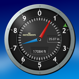
Offline altimeter app with elevation chart & altitude meter for hiking, cycling
This altimeter app is a GPS altimeter and altitude meter with a live elevation chart, built for hiking, cycling, travel and the outdoors, and it keeps working when you are completely offline. Open the elevation app and your current altitude is right there: one large, readable number, with one tap to switch between meters and feet.
WORKS WITHOUT A SIGNAL
Your altitude comes straight from your phone's GPS satellites, so this offline altimeter app keeps working with no cell signal and no Wi-Fi, out in the backcountry, in the mountains, or on a trail far from coverage. No account and no sign-up to get started.
ALTITUDE ABOVE SEA LEVEL
Raw GPS height is measured from an imaginary ellipsoid and can be off by up to 100 m. The app corrects it to mean sea level with the EGM96 geoid model, so the number matches your map and the trail signs. A clear source label shows when the correction is applied.
SAVE SPOTS AND SHARE THEM
Tap the bookmark to save a summit, a trailhead or a campsite: altitude, GPS coordinates and the time, kept on your phone. Share any saved spot as text with a map link, or tap your position to copy your GPS coordinates, handy when someone asks "where are you?"
SEE YOUR CLIMB
• Live elevation profile chart: watch your ascent and descent draw out in real time
• Ascent / descent rate: your current vertical speed in meters or feet per hour
• Session stats: minimum, maximum, and total elevation change since you started
• Your current location as latitude and longitude, with GPS accuracy
• Air pressure readout in hPa when your phone has a pressure sensor
CALIBRATE TO A KNOWN POINT
Standing at a trail marker or a peak with a posted elevation? Calibrate to that known value in a couple of taps, or accept the GPS suggestion, and every reading lines up from there. No paywall.
BUILT FOR THE OUTDOORS
• Large, high-contrast display designed to read at a glance outdoors
• Meters / feet toggle: tap the unit to switch, and it is remembered
• Quick Settings tile: swipe down and tap to open the live reading
• Battery-friendly: GPS pauses automatically when the app is in the background
• No sign-up, no account: just open it and go
USE CASES
• Checking elevation on a hike, trail run, or mountain bike ride with an altimeter app that needs no signal
• Watching your altitude gain and loss on a cycling climb
• Logging the summits and passes you reach on a trip
• Confirming take-off and landing elevation for casual drone flights
• Curiosity: see how high you are, wherever you are
HOW IT WORKS
The GPS altimeter reads altitude from your phone's GPS signal and corrects it to sea level. A location permission is needed for the GPS reading; choose "Precise", since approximate location carries no altitude. Elevation accuracy depends on your device, satellite signal and surroundings, so use it for hiking, cycling and casual outdoor activity, not for aviation, paragliding, or any activity that requires certified altitude data.
PRIVACY
Your location is used for the live altitude reading on your device and is never sent anywhere. Spots you choose to save stay on your phone until you delete them.
Open the app, check your elevation, and go.



One-click to install XAPK/APK files on Android!

Thanks for your rating and feedback!
You have already rated.