Use APKPure App
Get WebGIS old version APK for Android
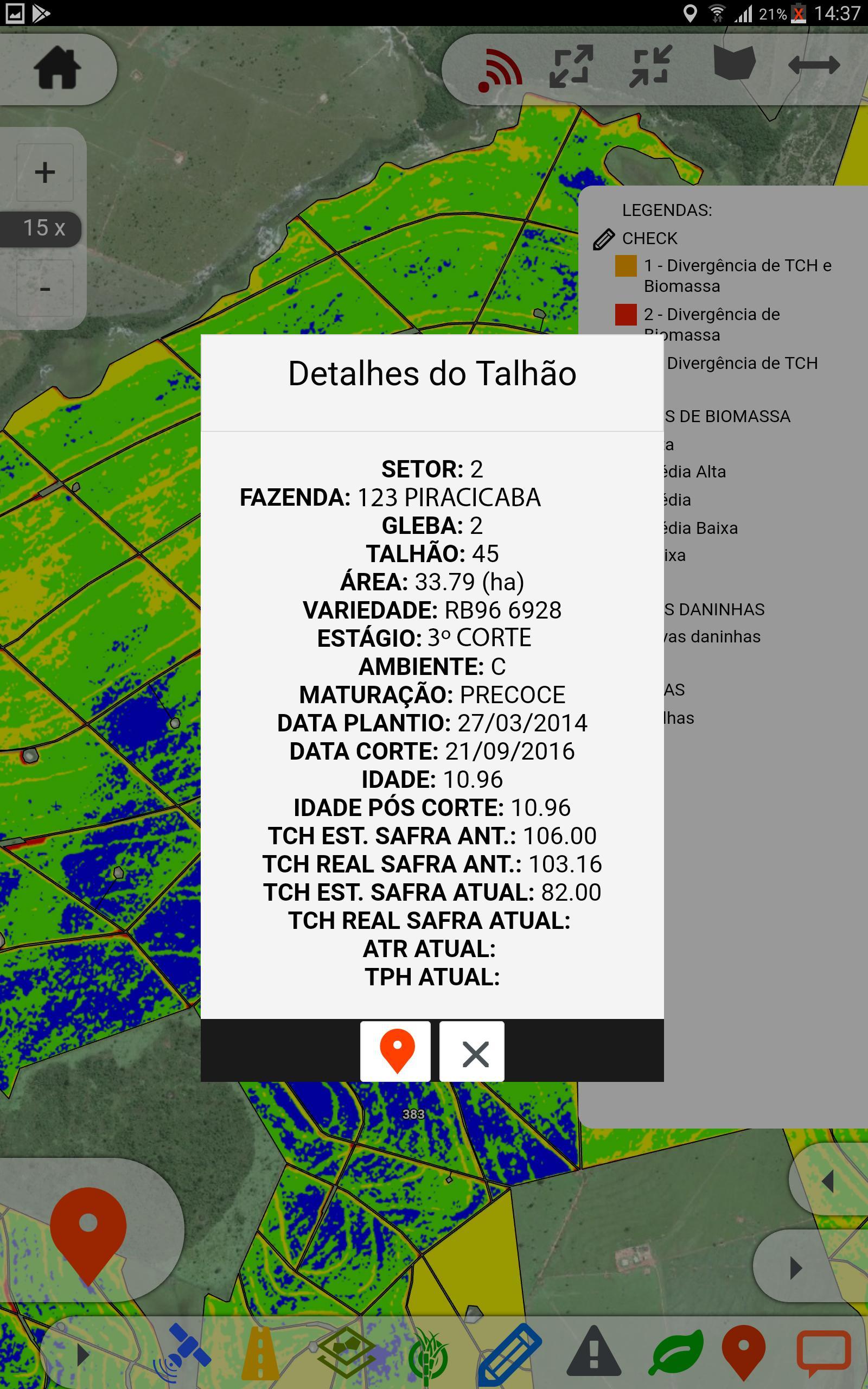
App for viewing maps and data with possibility to use offline (mobile)
The CATEK WEBGIS is a web and mobile platform for viewing maps and data in the field. Through the web application you can configure the layers (layers) display, such as Satellite Image, Farms, Plots with attributes, NDVI, faults, etc. import the files (SHP, TIFF) and data tables, as well as define the labels and color of subtitles. After the settings you can synchronize this information in the mobile app and view layer and data offline. Also can register categorized occurrences linking pictures from the location, set a responsible team and to create an action plan based on 5W2H. Resynchronize the data for WEB improving the knowledge of what happens on the field and assisting agricultural management.
To learn more contact the CATEK:
http://www.gatec.com.br/
http://www.gatec.com.br/mapfy/mapfy-gatec.pdf
Last updated on Mar 10, 2020
Estamos sempre mudando e melhorando o WebGis. Para garantir que você vai perder nada mantenha as atualizações automáticas ativas.
Latest Version
![]() 1.4.22
1.4.22
Uploaded by
Siri Saralitha
Requires Android
Android 4.0+
Category
Report


Discover what you want easier, faster and safer.

WebGIS
1.4.22 by GAtec Gestão Agroindustrial
Mar 10, 2020