Package Name:com.prodirt.trailmapper
Show More


3.6 MB
File Size
Everyone
Android 7.0+
Android OS
GPS trail mapping and export for property owners and trail contractors
TrailMapper is built for trail contractors, property owners, and outdoor builders who need accurate GPS trail records they can actually work with — not just a line on a screen.
🥾 TRAILMAPPER — GPS Trail Mapping for People Who Build Trails
📍 TRAIL RECORDING
• Background GPS recording — phone in your pocket, trail getting mapped
• Live GPS accuracy readout so you know what your line is worth
• Save and color-code individual segments by use type
• Split, smooth, and fine-tune trail lines after the fact
• Manual draw mode for tracing trails without walking them
🕸️ TRAIL NETWORK
• Connect segments into a full property trail network
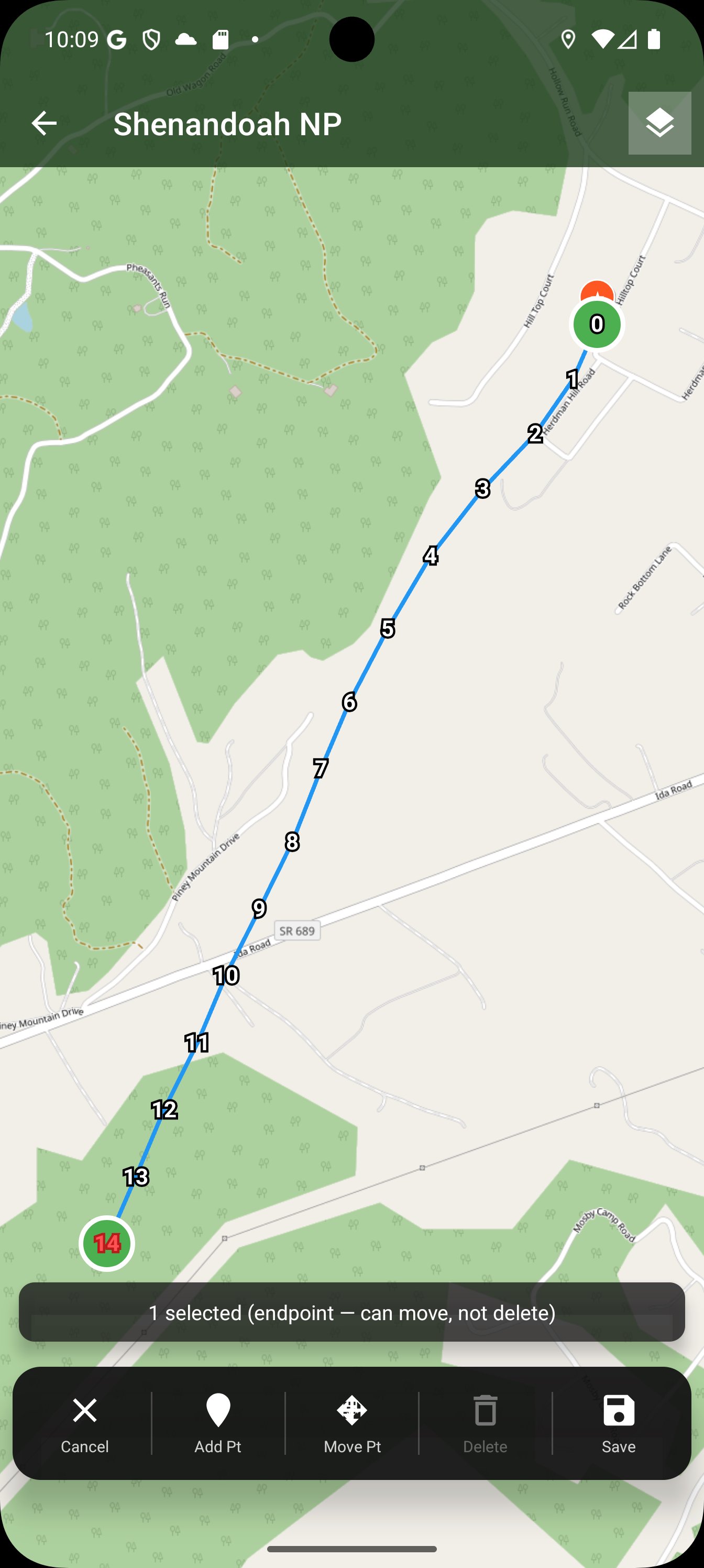
• Point editor for precise GPS adjustments on any segment
• Property boundaries — outline the whole parcel or mark separate zones (food plots, buffers, leased sections), each named and optionally shaded, all exported with your trails
• Merge Maps — combine two maps into one; every trail, POI and boundary from both, with the originals left untouched
• Multi-property support — keep jobs organized and separate
📤 EXPORT — SIX FORMATS
• KML — Google Earth, Google My Maps, and OnX
• GPX — Garmin, Trailforks, Wikiloc, and most GPS devices
• GeoJSON — for GIS work and web maps
• SVG — a clean vector drawing for proposals and print
• CSV — trails or POIs as a spreadsheet, for takeoffs and billing
• Network-stitched export, so trails import as connected lines
• KML/GPX import — load existing files from Google Earth or your GPS (Pro)
📌 POINTS OF INTEREST
• 9 preset types: parking, gates, water crossings, overlooks, hazards,
rest areas, intersections, wildlife and camping
• POIs ride along in KML/GPX export — they show up in Google Earth and OnX
• Add photos to any POI directly from the field
💧 WATERWAYS OVERLAY
Toggle on streams and creeks from USGS National Hydrography data and OpenStreetMap, drawn right over your trails. See your crossings before you build them — the water decides where the bridges, permits, and erosion problems go.
🏔️ 3DEP LiDAR TERRAIN
See the shape of the ground, not just the map. The new USGS 3DEP layer is a LiDAR-derived hillshade that puts every ridge, draw, bench, and drainage in relief — run it as your base map or as a see-through overlay on satellite or topo. It renders live, so it stays sharp at any zoom. Scout pinch points and bedding before you set foot on the property. (Public-domain USGS data — US coverage.)
💵 QUOTING
• Build line-item quotes tied directly to trail segments
• Share summaries with property owners or clients
• Keep scope and pricing in one place instead of scattered across notes
🗺️ MAP & NAVIGATION
• Offline-capable map — works without cell service deep in the property
• Cache map tiles ahead of time for areas with no signal
• Layers panel — show or hide trails, POIs and boundaries independently, and tap any one by name to fly straight to it
• Elevation profile per trail segment
• Standard, OpenTopo, USGS Topo and Satellite base maps
• Center-on-me button for when you've lost yourself in the pan
☁️ BACKUP & RESTORE (Pro)
• Back up your full property database to Google Drive or local storage
• Restore on a new device without losing field data
• No TrailMapper account required — backup goes to your own storage
💾 FREE VS PRO
Free: up to 2 properties, full feature access, all six export formats.
Pro is a one-time purchase: unlimited properties, backup and restore,
and KML/GPX import.
🌐 OFFLINE & PRIVACY
Your trails, POIs and quotes live in a database on your phone — no account, no cloud sync, no server holding your work. Pro backup goes to your own Google Drive, not ours. Cache tiles ahead of time and the app works with no signal at all.
No subscription. No account. No cloud. All GPS data stays on your device.
🆘 SUPPORT
Email: [email protected]
Website: https://prodirt-llc.github.io/trailmapper/
Built by ProDirt LLC — a Virginia-based trail construction company.
This app exists because we needed it.




One-click to install XAPK/APK files on Android!

Thanks for your rating and feedback!
You have already rated.