
Package Name:com.geofieldai
Show More

Offline geological mapping, compass, structural, hydrogeology, slopes and AI
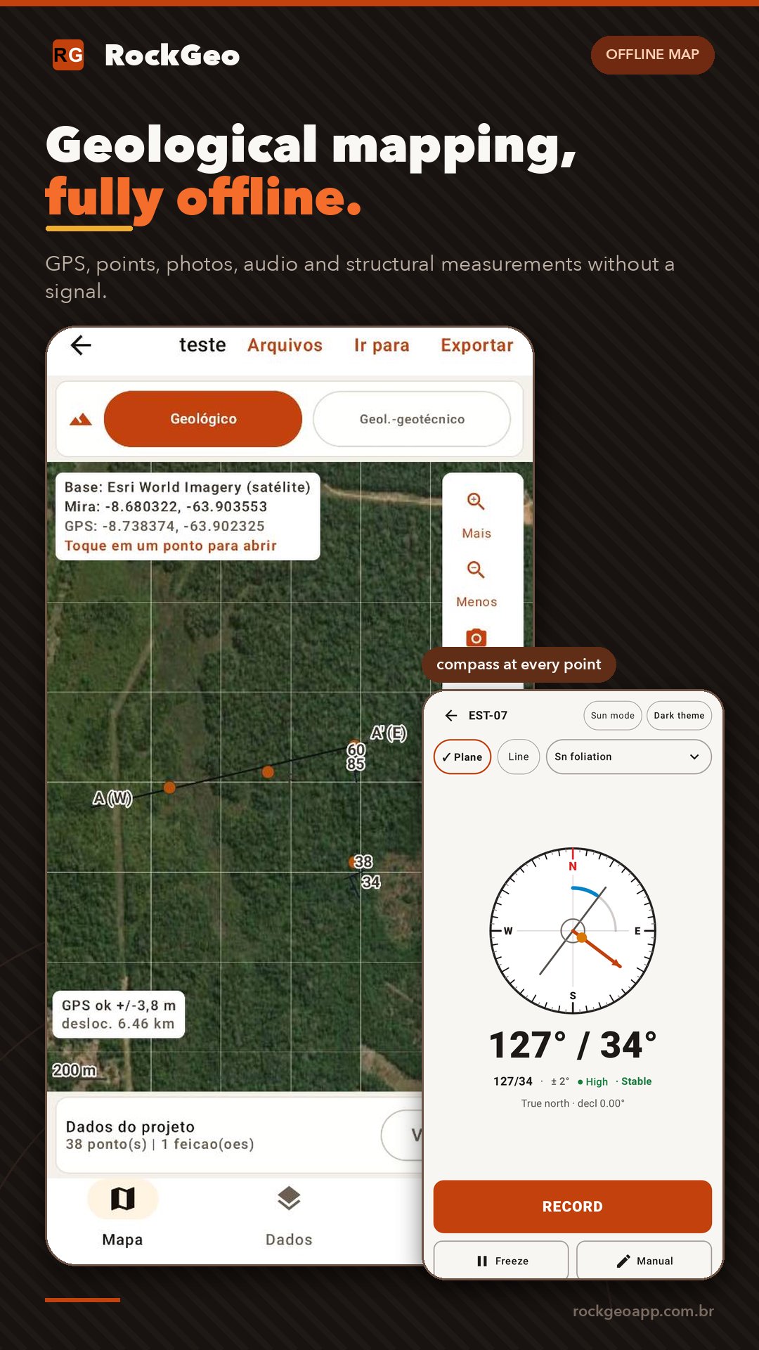
Offline geological mapping with a geological compass, structural geology, hydrogeology, geotechnics, environmental and mining tools in one app.
RockGeo is the digital field notebook for geologists, geotechnical engineers, hydrogeologists, mining and environmental teams and geology students. Record points with GPS, photos, audio and structural measurements without a signal, then take the project through analysis, maps and reports.
CHOOSE YOUR TYPE OF WORK
When you create a project, choose general field survey, geological, geological-geotechnical, hydrogeological, structural, mining or environmental. The app shows the fields and tools for that work.
FIELDWORK WITHOUT A SIGNAL
• Map with GPS, layers and offline basemaps.
• Points with photos, audio, lithology, samples and configurable code sequences.
• Voice dictation in every text field, with AI correction.
• Sun Mode: high contrast, larger text and big buttons for bright sun and gloves.
GEOLOGICAL COMPASS AND CLINOMETER
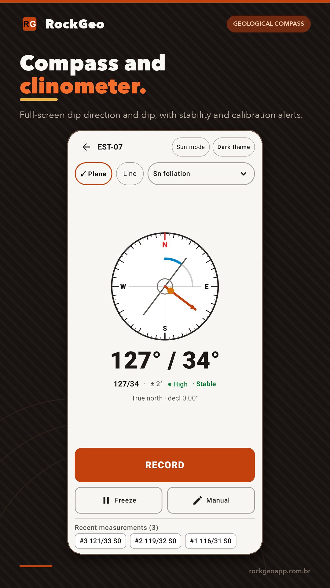
• Full-screen compass for planes and lines: dip direction, dip, strike, trend and plunge.
• Opens wherever you measure (geological, geotechnical, boreholes and structural), with vibration and sound on capture.
STRUCTURAL GEOLOGY (PRO)
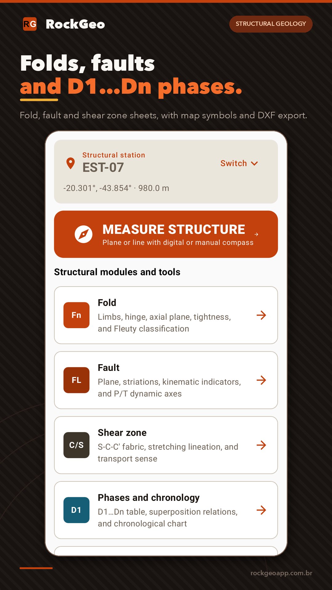
• Stations with S0 and way-up, Sn, cleavages, C/S/C′, faults, fractures, veins, dikes and kink bands.
• Lineations, fold axes, slickenlines with pitch, boudins, mullions and D1…Dn phases.
• Fold (Fleuty, vergence), fault (sense, kinematic indicators, P/T axes) and shear zone sheets.
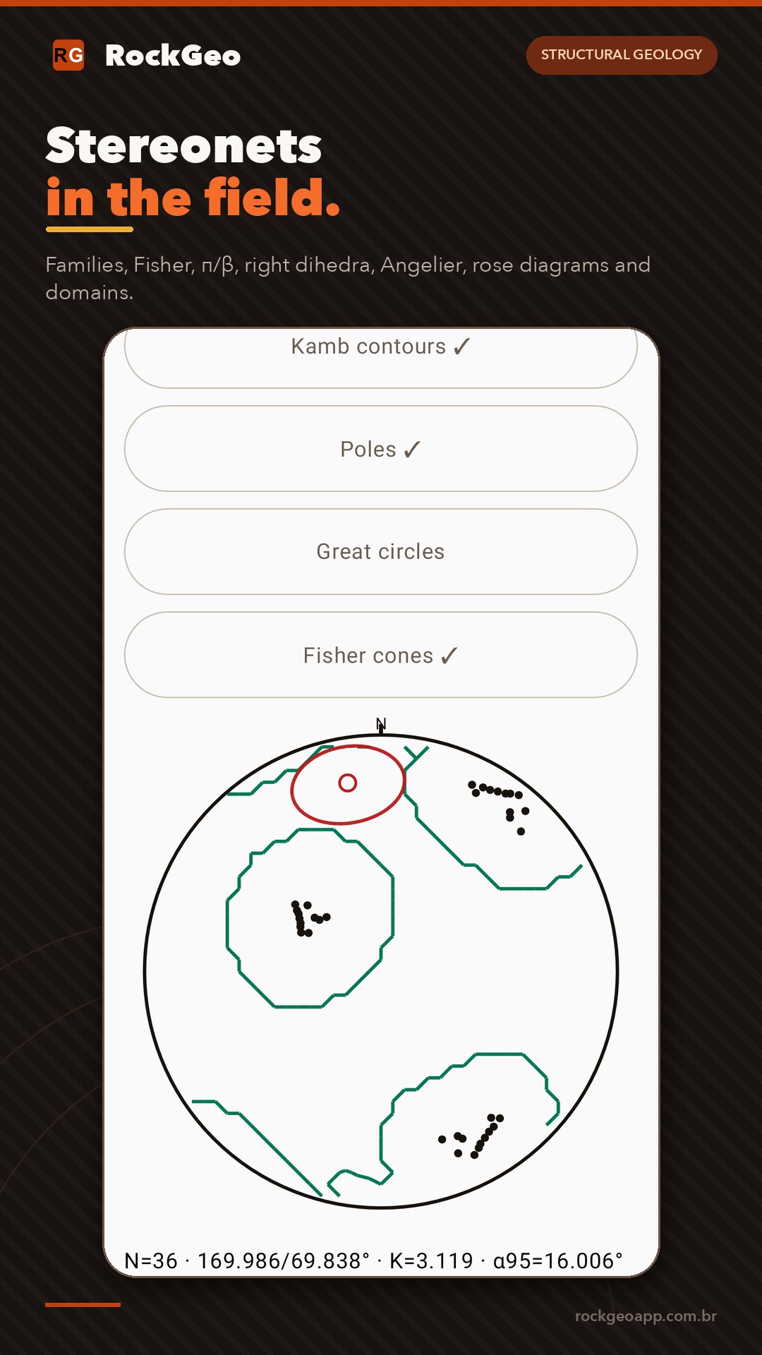
• Stereonet with filters, Fisher mean and cone, π/β, right dihedra, Angelier, rose diagrams and domains.
• Structural symbols on the map; export to DXF, GeoPackage and PDF.
GEOTECHNICS AND SLOPES (PRO)
• 2D limit equilibrium slope stability (Bishop, Janbu, Spencer, GLE) with water, surcharge, seismic load and calculation report.
• Kinematic analysis for planar, wedge and toppling failure.
• Boreholes, SPT and 2D geological-geotechnical sections linked to stability.
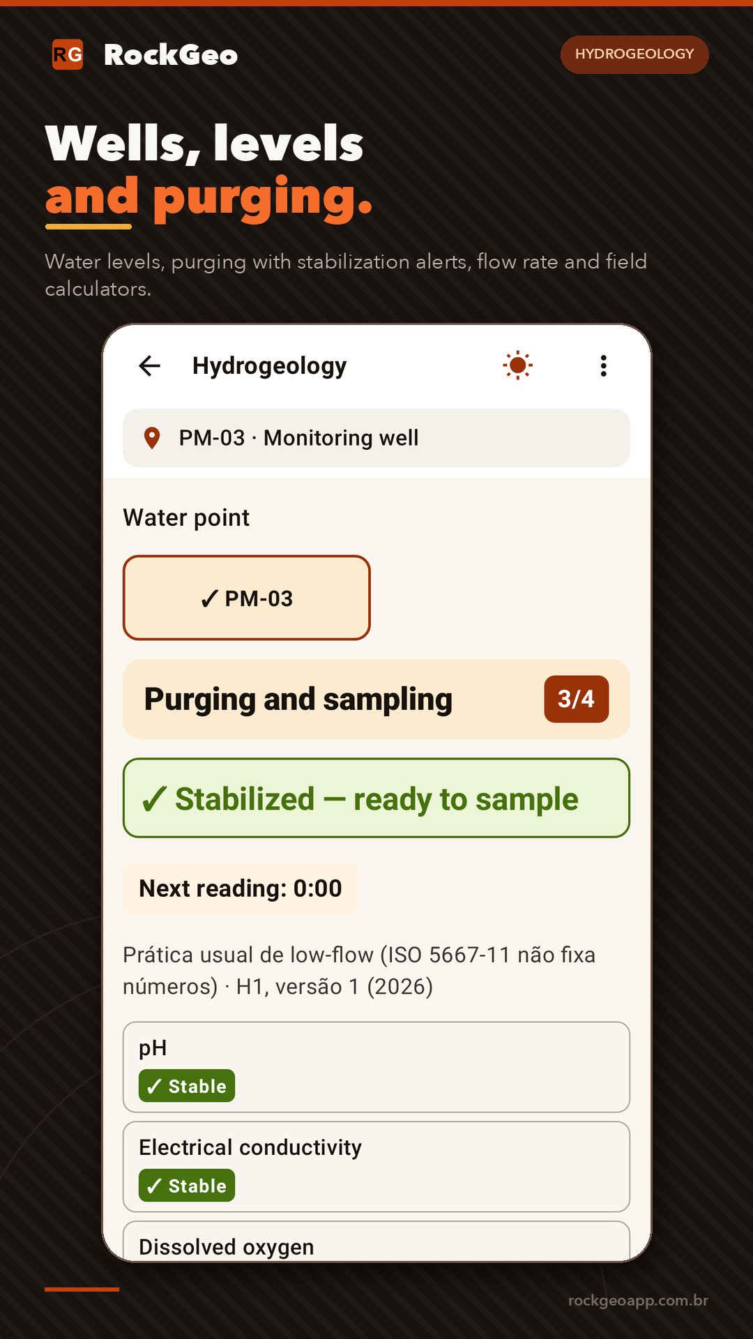
HYDROGEOLOGY (PRO)
• Wells, piezometers and springs on the map; water level, hydraulic head and LNAPL.
• Purging with stabilization alerts by profile (international, EPA, NBR), flow rate with stopwatch and weirs.
• Field calculators: Darcy, transmissivity and specific capacity.
ENVIRONMENTAL AND MINING (PRO)
• Environmental: regulatory profiles from several countries, chain of custody, exceedances and VOC/PID screening.
• Mining: sampling, drill holes, lab certificates and QA/QC.
TEAMS AND COMPANIES
• Projects with members (Pro): email invitations and owner, manager, editor, collector and viewer roles.
• Business plan: a company workspace separate from your personal one, with 3, 5, 10 or 25 seats, AI credits and organization storage.
• RockGeo Portal in the browser, synced with your phone.
AI THAT KNOWS YOUR PROJECT
Ask about data gaps, risks and next steps, and generate technical reports from points, photos, audio, analyses and sections. For subscribers, using AI credits.
IMPORT AND EXPORT
• Google Earth: KMZ with photos and each point's description.
• Free: KML, KMZ, CSV, GPX and full backup.
• Pro: Shapefile, GeoJSON, GeoPackage, DXF, PDF and DOCX for QGIS, ArcGIS and AutoCAD; import GeoTIFF, GeoPDF, MBTiles, Shapefile and DXF.
WHAT IS FREE
Classic geological mapping and general field survey: unlimited projects, map, GPS, points, photos, audio, structural measurements, on-screen stereonet and export of your data to KML, KMZ, CSV and GPX. No ads.
PLANS
Pro (monthly or yearly), Academic and Business, billed and auto-renewed by Google Play, cancel anytime in Google Play subscriptions. Extra AI credits available in the app.
Technical notice: RockGeo is a support and screening tool. Data, analyses and AI-generated text must be checked by a qualified professional before engineering or design decisions.
RockGeo is a product of Thard Tech (Brazil).



One-click to install XAPK/APK files on Android!

Thanks for your rating and feedback!
You have already rated.